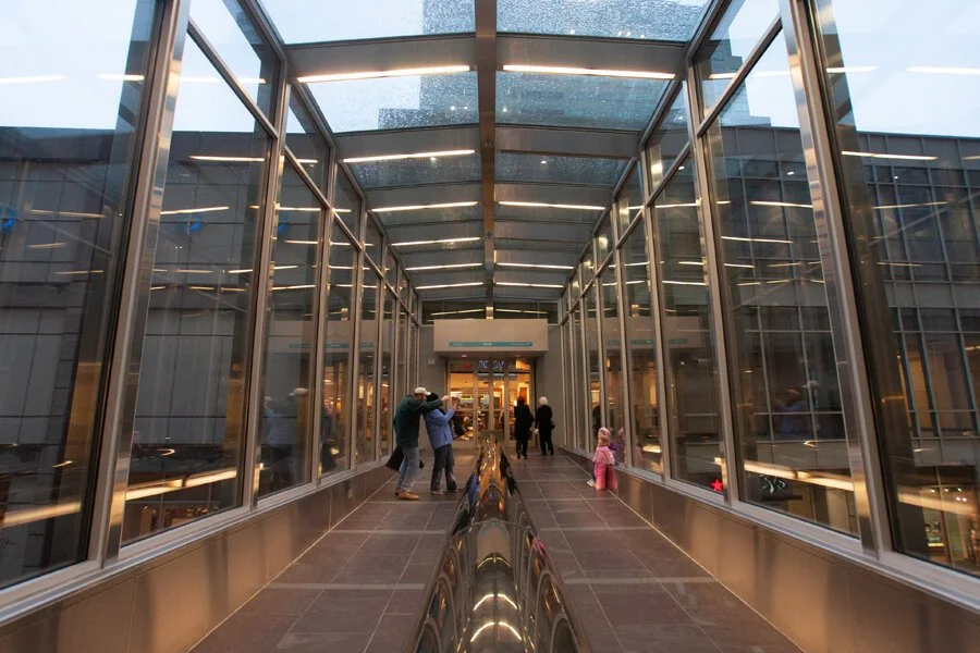
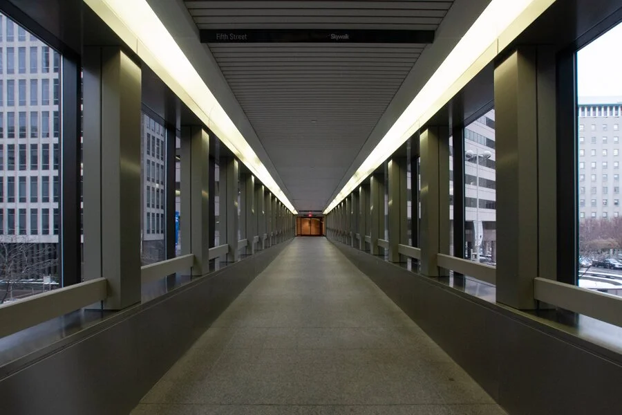
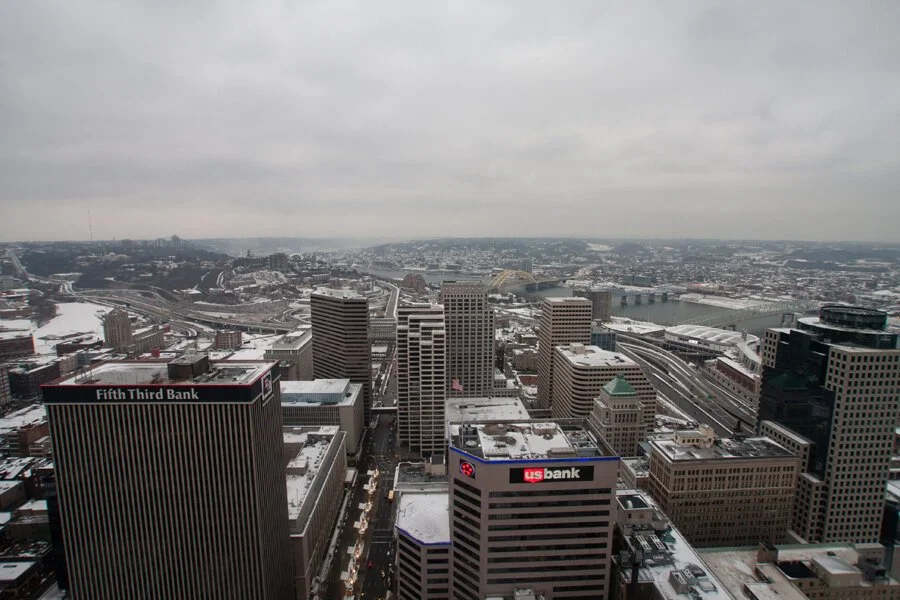
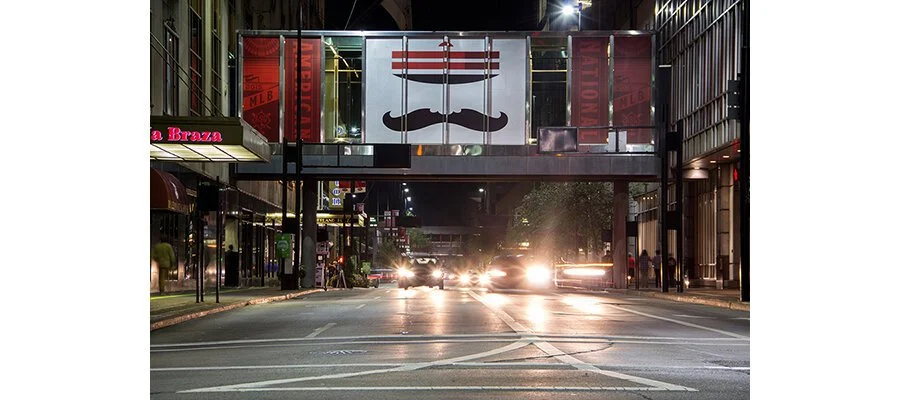
From the Archives: the Cincinnati Skywalk in December 2008
I recently posed a question on Twitter: “If you could time travel to any location/point in history, where and when would you travel to?” The answers ranged from the first moon landing to meeting Jesus Christ, the Wright Brothers’ first flight, killing Hitler, the Treaty of Versailles, and sports championships. Among the thoughtful responses, though, not a single soul (despite my hint) said that they’d travel to the Cincinnati Skywalk system in December of 2008.
Which is a shame, because if you’ve found yourself here on QC/D today—I’d like to welcome you to the world’s most unfulfilling time machine.
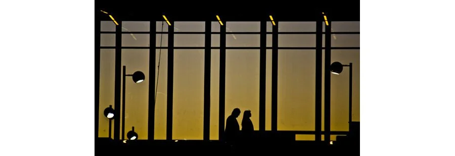
An even older Skywalk photograph, from QC/D in 2007.
There’s a quote that Commander William Adama utters in the Battlestar Galactica miniseries. While I’m sure everyone knows it, I’d bet there’s a few out there who don’t.
“How? Why? Doesn’t really matter now.”
And that’s how I view this particular post. There’s nothing significant about December 6, 2008. You could even argue that the Skywalk itself, a vestige of shortsighted urban planning, isn’t even significant. I just happen to have these photographs from that particular time. How did I dig them up? Why am I digging them up? Well, that doesn’t really matter now, but maybe there’s someone out there who will appreciate them. And to that person: “so say we all.”
Just for some context: these images were part of an older QC/D story, one from the early days. I featured them in an interactive slideshow called “Downtown’s Ghost Town.” The post had a look at the history of elevated urban skywalks, how Cincinnati’s system came to be, and how these walkways were eventually maligned and discredited by both urban planners and civic officials alike. I made these photographs not so much with artistic reverence in mind, but rather, as a documentation. They were all featured as slides in a gallery that paired each image with a Google Maps screenshot. As the viewer advanced, they could see what direction they were facing and where amongst Downtown they were located.
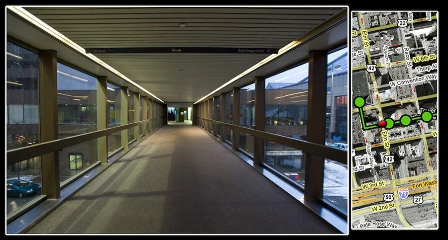
Screenshot of the original QC/D feature published in 2009.
An brief aside:
As I went about writing this post, I found myself enjoying the “skywalk down memory lane” so to speak. I made these photographs and wrote the original post over a decade ago, when this website and my various work was in its infancy. Looking back on them now, they reminded me of why I even explored the Skywalk in the first place: to explore a city I’ve always called home, to dive deeper into a place I loved—a place I have much different relationship with now. Writing this today, there’s been a lot of random thoughts along the way and even a question of local infrastructure history that appears at the end. While it may seem insignificant in the grand scheme of things, it was important to me at the time. So to echo the opening paragraph, hopefully someone else finds an appreciation in walking along the Skywalk on a cold day.
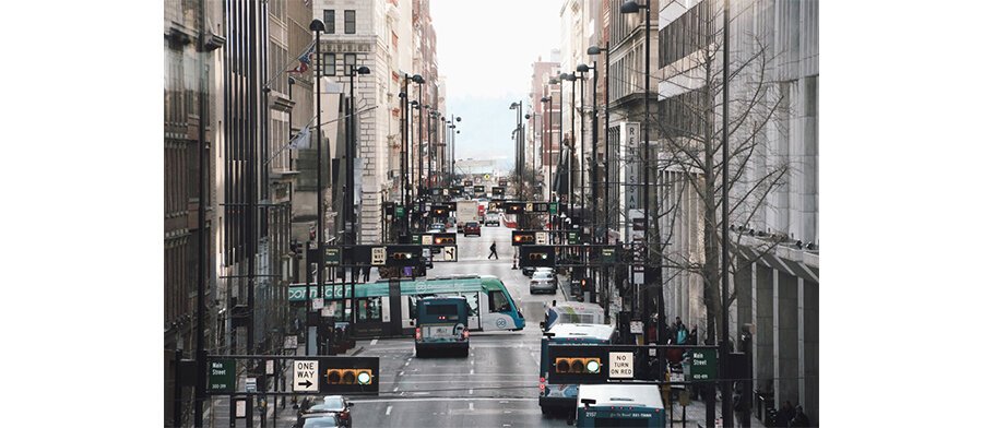
Even by 2008, portions of the Skywalk system had already become disconnected. These days—its existence, promotion, and viability aren’t really a priority for anyone besides the curious (or office workers settling on that one mediocre lunch option because it happens to be raining and there happens to be a piece of remaining Skywalk going in roughly that direction). When the original story went up, there was already talk of retail and pedestrian traffic returning to the city’s streetscape. Nearly twelve years later, Downtown has developed in ways 19-year-old me could’ve never envisioned. While pedestrians are far from being a priority in the eyes of the city’s planning decisions—the people are navigating streets in greater numbers than the Skywalk system.
Cincinnati Refined did a great story in 2017 (with wonderful photography by Phil Armstrong). Here in 2020, the Skywalk as it was in 2008 is pretty much still there. The city around and below it, though, has changed quite a bit.
As for the original post/gallery—like the skywalks themselves—it was quickly outdated. The “virtual tour” was created via Adobe Flash. Is your Flash Player up to date? Doesn’t matter, because no one’s using Flash anymore, specifically because many smartphones never jived with it. After all of QC/D disappeared for a few moments during some technical issues, I opted to not bother restoring the old Flash gallery. It would’ve taken too much time and hell, who could’ve seen it anyways? Would anyone really want to see documentation of the Cincinnati Skywalk system as it was in December of 2008?
Apparently you do, because you’ve made it this far.
While many of us are still laying low during the COVID-19 Pandemic, let’s go tour the Skywalk and we’ll discuss some historical anecdotes along the way. All while remembering a time when we could go outside...just to go back inside...on the Skywalk...in those halcyon days of when I was saving up to buy an Xbox 360.
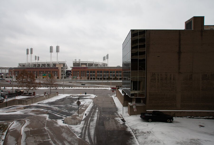
Looking at the site of the former stadium connection.
Back in the day, the Skywalk reached all the way to the riverfront at the aptly named Riverfront Stadium (later Cinergy Field) and Riverfront Coliseum (Heritage Bank Center today). This bridge extended over the interstates of Ft. Washington Way from the Atrium 2 office building. Back in 2008 and today, the former connection plaza was an outdoor seating/smoking area for office workers. I’m not sure if the former stadium bridge was “officially” part of the Skywalk branded system, nor when it disappeared. If memory serves, it was demolished before Riverfront was replaced by Great American Ballpark.

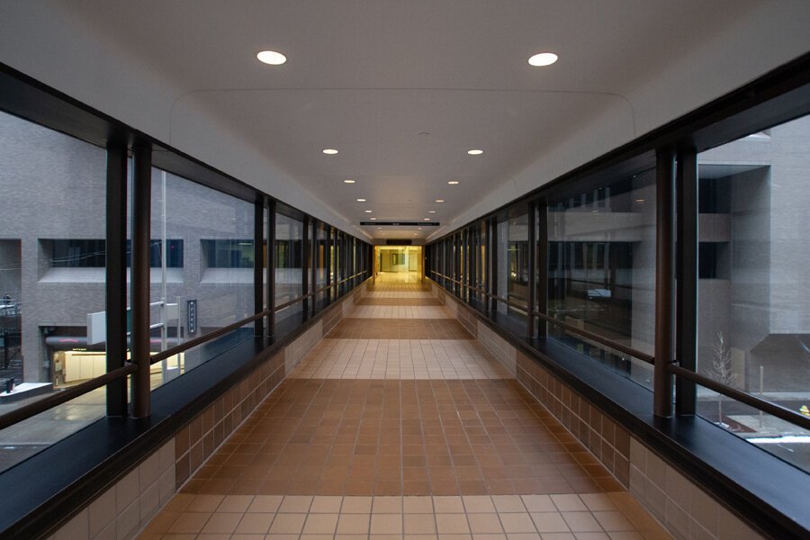
This above segment crossing over East 4th St. still exists, connecting to a nearby parking garage. For years, one of the final vestiges of Downtown fast food existed below: the 4th St. Wendys. Now, it’s some sort of health center and you can only find spicy chicken nuggets in outlying neighborhoods. This bridge, though, has a nice view of 4th St.’s “skyscraper canyon.”
February 2017 photograph made from the 4th St. Skywalk bridge.
Rest in peace, Wendy’s (and Gozer, if you're reading this, thanks for buying me dinner there before a Fountain Square broomball game in 2010).

Connections through the office complex at 4th and Main.
Crossing over East 5th St. towards the former Chiquita Center now Columbia Plaza.
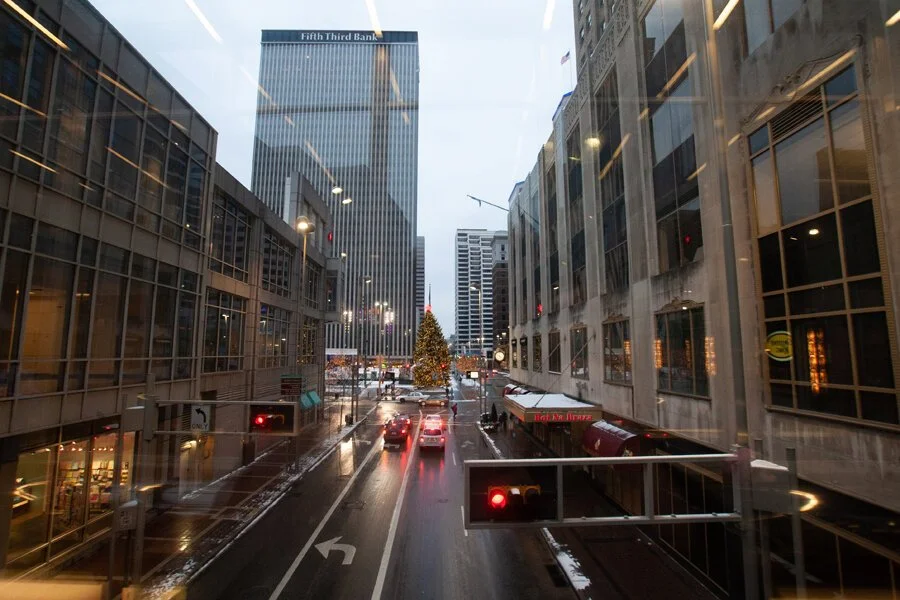
From the bridge in the previous image: looking west along 5th St. towards Government Square, Fountain Square, the Fifth Third Center, and Carew Tower.
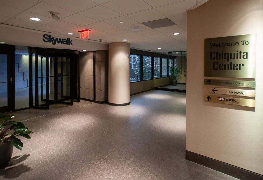
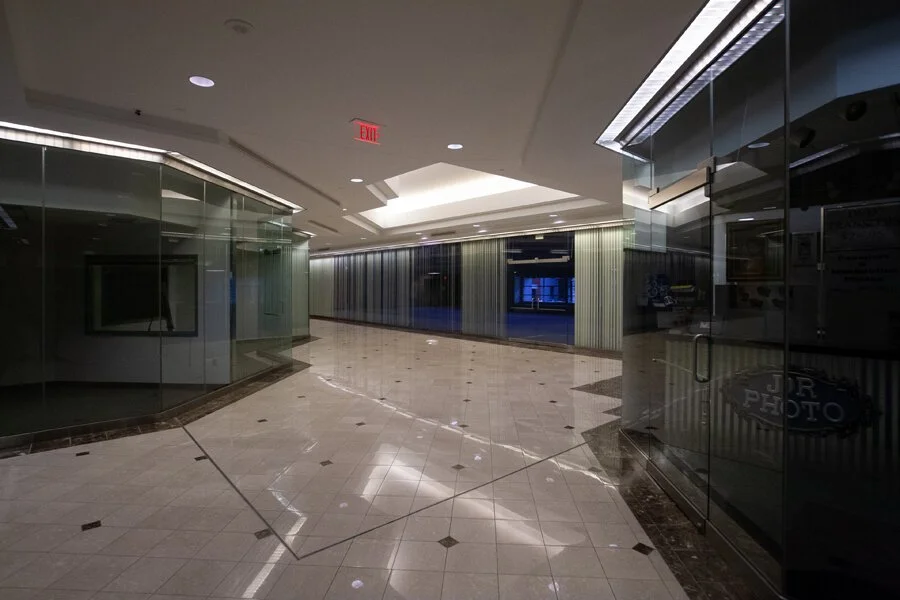
The above photograph shows Skywalk wayfinding in what used to be known as the Chiquita Center. Chiquita eventually left their namesake headquarters during a relocation to Charlotte. In the years since, they’ve relocated their headquarters once again to Switzerland. Today, the building is home to the Nielsen firm’s BASES operation, as well as, a variety of other tenants and even residential floors. The building is now known as Columbia Plaza.
A section of the Skywalk that runs out of the former Chiquita Center towards the John Weld Peck Federal Building. The outdoor plaza was renovated extensively in 2019 and may or may not still include an advertised entrance to the Skywalk system.
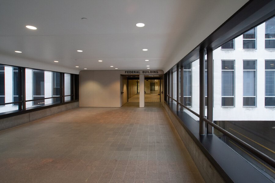
A bridge to the John Weld Peck Federal Building over Paulding Alley.
Looking north from within the bridge of the previous image, up Main St. through Downtown between the Federal Building and former Great American Insurance headquarters.
This above connection of the last two images still exists, but the former Great American Insurance headquarters have been renovated into "AT580" featuring residential and office space. At the time this photograph was made, Great American Insurance was preparing to relocate to the then under construction Queen City Square skyscraper.
Seen above: the bleak, mostly empty interior of what’s now known as the AT580 building. These days, this public walkway is far more active with a number retail spaces filled including a great, greasy breakfast spot known as AT580 Market Gourmet. Still, the AT580 building was renovated to include ground-level, street facing retail. Today, it hosts a Taco Bell Cantina, Wahlburgers, Starbucks, and other dining options at street level.
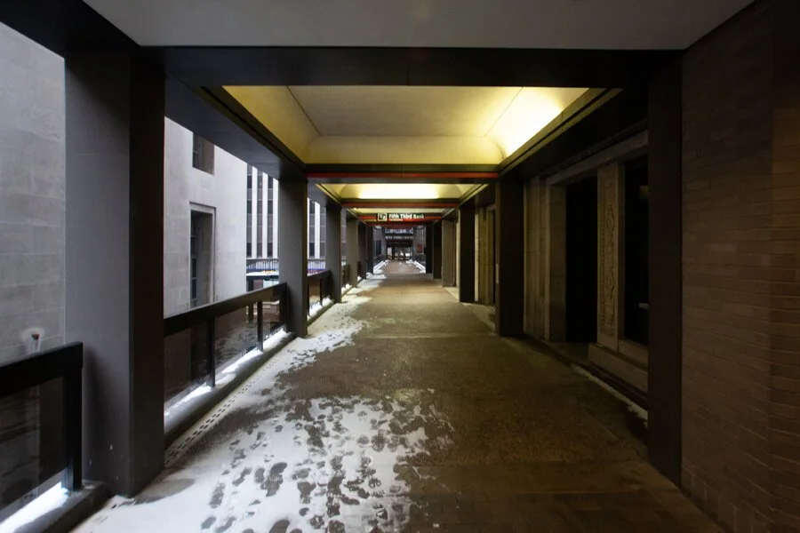
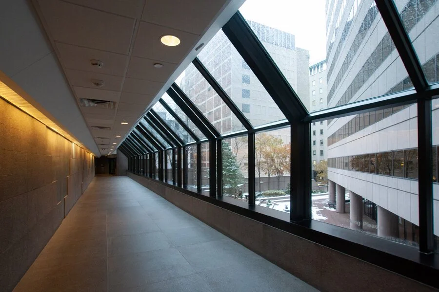
When skywalks (also commonly referred to as “skyways” and “skybridges”) were initially championed in places such as Minneapolis—the idea was that they’d allow urban, downtown areas to compete with the rise of suburban shopping malls by providing indoor, climate-controlled walkways that could protect pedestrians from the harsh elements. As reported by The Cincinnati Enquirer in 2003, though, the Queen City seemed more interested in reserving the streets for cars while offering pedestrians an alternative route that would protect them from vehicles utilizing the streets. With a network built out over several decades, Cincinnati’s system occasionally features links that are exposed to the outside environment such as the partially snow covered bridge at Walnut St. seen above.
Both in 2008 when the above photograph was made (and still today) the bridge over Walnut St. featured stairways to both sides of the street. Before Fountain Square was heavily renovated around 2005, the above section of outdoor Skywalk extended along the square and over Vine St. into a nearby building. Both the Vine St. bridge and portion running along the square were demolished during the renovation.
Over the years, while working Downtown, I’ve been told by private security guards (even before the 2018 Fifth Third Center shooting) that the Skywalk bridge seen above is solely for Fifth Third employees and that taking photographs from it is “illegal.” I’m pretty sure that’s not true, nor is it really clear who maintains the Skywalk system as an entity. Either way, it’s a good place to glimpse murals, get some nice shots of the city, and private security guards are not cops or lawyers.
July 2018 photograph made from the northern Walnut St. Skywalk bridge.
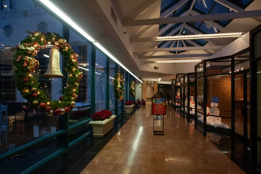
Fountain Square at the heart of Downtown Cincinnati is a pedestrian hub surrounded by ground level retail and dining sitting atop a large parking garage and featuring easy connections with both the Streetcar and Metro bus systems. If one is dead set on sauntering the Skywalk, though, there are a few options. The direction seen in these photographs so far covers east of the Square. Additionally, Skywalk segments can be found to the south in the Westin Hotel/US Bank building or to the west in the Fountain Place building. Since the Vine St. bridge was already gone when I made these photographs, I went south into the Westin.
The Westin Hotel at holiday time.
From the Westin, the Skywalk actually branches off eastward into the Mercantile Center with connections to both 4th and 5th St.
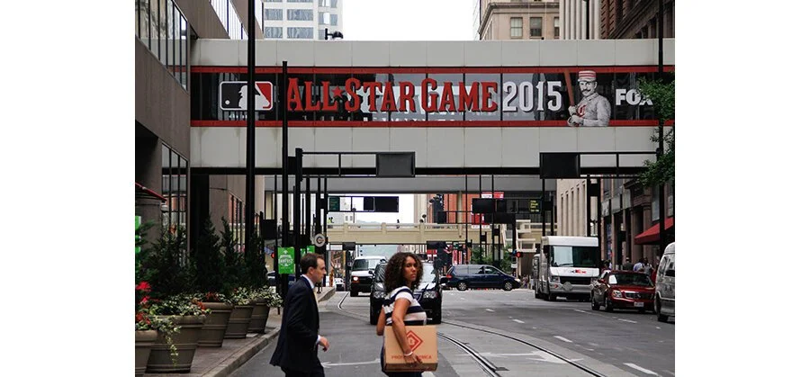
The branch that connects over Walnut St. to the Mercantile Center as seen in the summer of 2015, decorated for the Major League Baseball All Star Game.
I, for whatever reason, did not photograph that segment or realize it existed at the time. Instead, I went westward toward the Carew Tower.
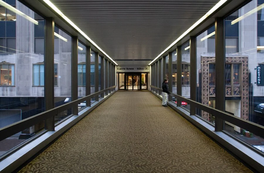
Bridge above Vine St. connecting the Westin Hotel with the Carew Tower and Hilton Cincinnati Netherland Plaza.
The Carew Tower and its arcade have undergone a lot of re-envisioning and renovation over the years. At one point, someone believed that the building’s indoor shopping/retail areas would be enhanced by connections with the Skywalk system. As trends changed over the years, this proved to not necessarily be true.
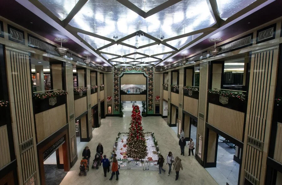
The Carew Tower Arcade as seen during the 2008 holiday season.
The Carew Arcade still features a handful of tenants today, but it’s a far cry from the retail glory days of its debut in 1930. Like many of its Downtown counterparts, the retail and dining focus has shifted outdoors to the street level. As one of the city’s most historically significant and tallest skyscrapers, though, it also features one of the greatest local gems (a place personally very significant to me): an outdoor observation deck.
View from the Carew Tower observation deck in December 2008.
From the Carew Tower, the Skywalk then connects both north and continues west. Heading north, a bridge above West 5th St. still leads into Fountain Place today. The Macy’s Department store of Mike Leake shoplifting fame, however, closed in 2018.

The bridge above West 5th St.
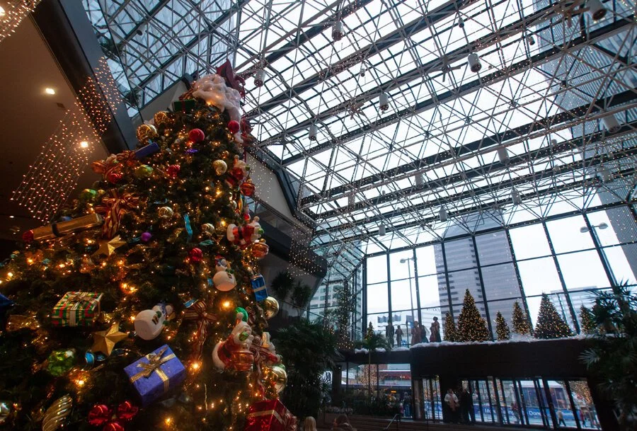
Looking east from the West 5th St. bridge with Fountain Square’s Christmas tree and the Fifth Third Center in the distance. The Carew tower is to the immediate right.
Macy’s wound up with its world headquarters in Queen City due to a series of mergers and acquisitions (a story that can be learned via a “ghost sign” in Fading Ads of Cincinnati).
Their corporate offices were located a few blocks north of the Fountain Place store (not accessible by Skywalk). In February 2020, Macy’s announced that they’d be closing their Cincinnati offices, shuttering 125 stores, laying off 2,000 employees, and relocating their headquarter operations to New York. As for Fountain Place, the department store isn’t the only tenant it has lost since these photographs were made in 2008.
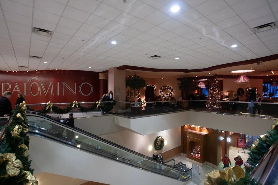
The former Palomino restaurant at Fountain Place.
The ground level Tiffany and Co. store relocated to the suburbs in the fall of 2017 while the upscale Palomino restaurant closed around a year later in 2018. Another year later in 2019: a great independent, local bookstore known as The Booksellers also closed. Fountain Place is currently in the process of being renovated in hopes of luring new tenants. Who knows how that will be affected by a COVID-19 tainted economy, though. The three-story building is best known for housing the Fountain Square Jumbotron and is actually designed to be built further upward if demand calls for it.
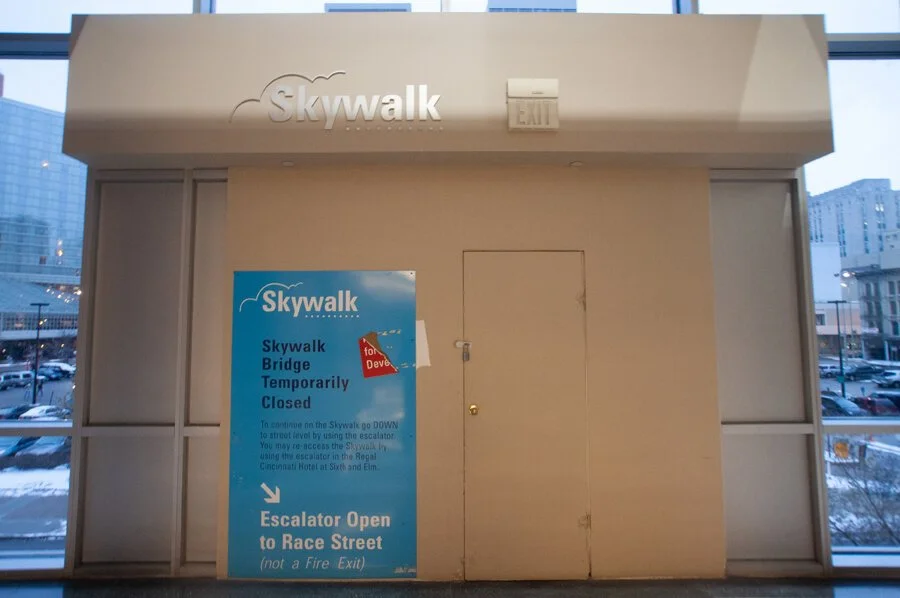
At the other end of Fountain Place, the former location of a Skywalk bridge sits closed in 2008.
After a nearby building was demolished and replaced with a parking lot (I believe as part of the failed effort to lure a Nordstrom Department Store), this section of Skywalk seen above was abandoned, or, only “temporarily closed” as the poster stated. At the time the photograph was made, the derelict bridge was still standing on the other side of that wall. According to Google Street View, it was removed some time between April 2012 and July 2014. Today, the aforementioned parking lot has been replaced by a new building serving as the headquarters of 84.51° and a slew of street level retail and restaurants. The Skywalk connection was never restored. To continue the tour, both back then and virtually now, one must return to the Carew Tower.
In 2008, the Carew Tower complex was far different than it is today. In addition to the shopping arcade, there was also once a fully built out indoor shopping mall known as Tower Place. Billed as “at Carew Tower,” the shopping mall was actually built on the site of a former H. & S. Pogue Company department store (a local company whose remains would eventually become part of the Macy’s conglomerate through a series of mergers and acquisitions). Tower Place featured a direct indoor connection to the Carew Tower Arcade, as well as, a pair of Skywalk bridges over Race St. to the nearby Saks Fifth Avenue department store.
At the time of these photographs in December of 2008, Tower Place’s food court was still hopping and the retail had fared far better than similar downtown malls built across America’s urban centers. If I recall correctly, there was still a Radio Shack, FYE, and Victoria’s Secret during the 2008 holiday shopping season among other name brands.
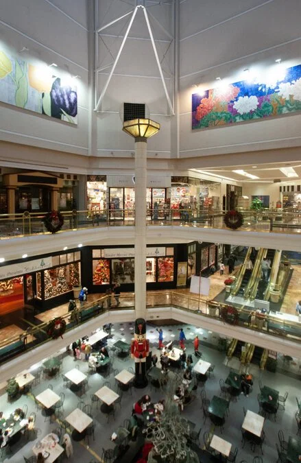
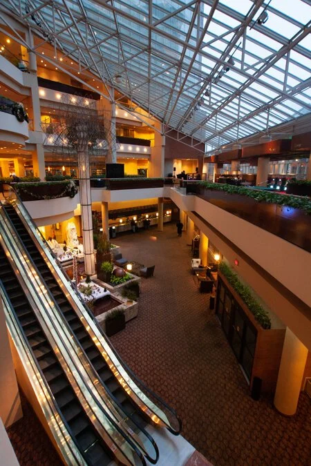
Tower Place Mall during the 2008 holiday shopping season.
Tower Place eventually met the fate of so many malls (both suburban and downtown alike): it died. Cameron and I authored a story on the place in 2013 right before it disappeared. The nearby spiral parking garage built for the H. & S. Pogue Company was demolished in 2016.
A Skywalk bridge decorated for the holidays between Tower Place/Carew Tower and Saks Fifth Avenue. This southern bridge has since been demolished.
Looking south from the second/northern bridge that connected Tower Place/Carew Tower and Saks Fifth Avenue over Race St. While this connection still exists, the other bridge in the distance is the one seen in the previous photograph.
The now demolished southern Race St. Skywalk bridge also once supported a little-known automobile bridge between parking garages. This particular photograph is from the 2013 story on Tower Place.
The northern Skywalk bridge over Race St. between Tower Place/Carew Tower and Saks Fifth Avenue featured, and still does feature, escalators connecting to the Carew Tower’s first floor.
Tower Place was eventually gutted and turned into a massive indoor parking garage. It still maintains a few retail and dining tenants. However, in the general theme of this tale and modern urban design trends: these new establishments are located at ground level and facing the street. The last of Downtown Cincinnati’s department stores (if you don’t count the amazing place known as “The Chong”), Saks Fifth Avenue is located along the Skywalk system across the street.

Skywalk above the Saks Fifth Avenue department store. Around the corner is the Hyatt Regency Cincinnati hotel.
The Hyatt Regency Cincinnati decorated for the 2008 holidays.
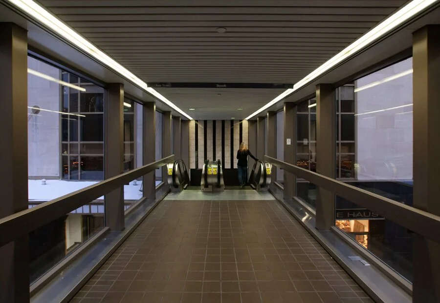
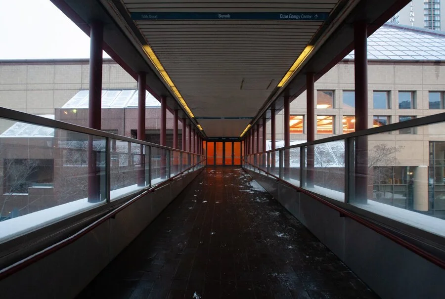
From the Hyatt, the Skywalk then continued/continues to a nearby office building as it works its way towards the Duke Energy Convention Center. The first segment of Skywalk constructed was built to connect Fountain Square with the convention center. I’m not sure which route exactly was the original segment, but we’ll get into that at the end.
Crossing Elm St. Note the design aesthetic that screams “1970s airport.”
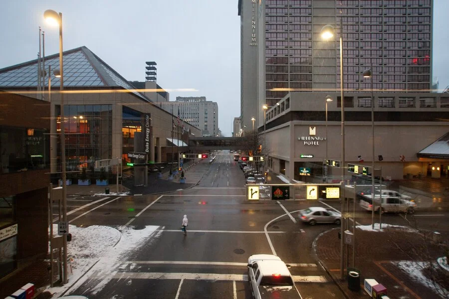
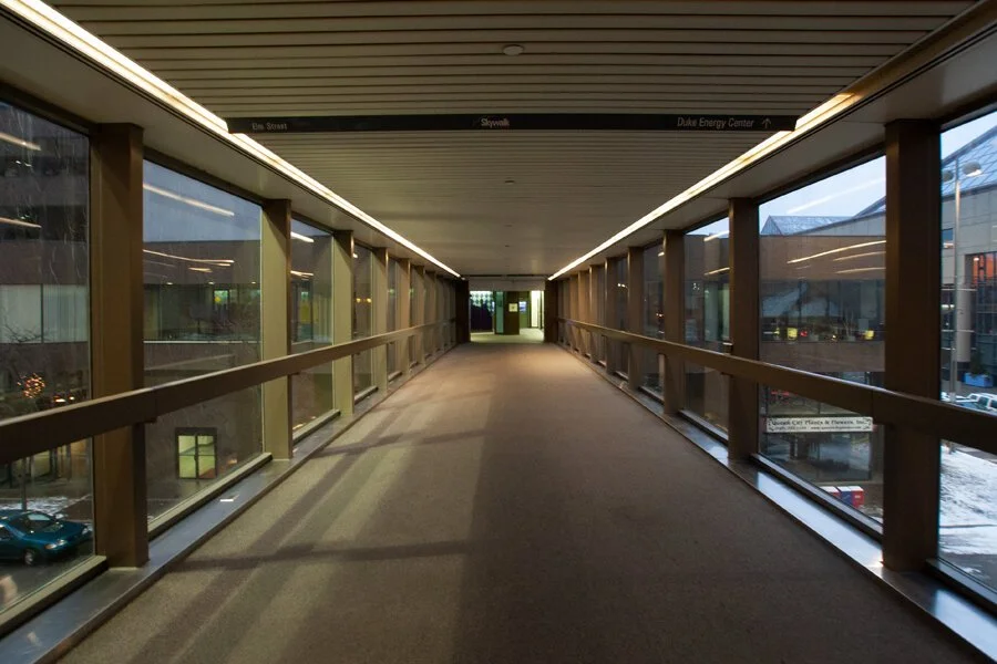
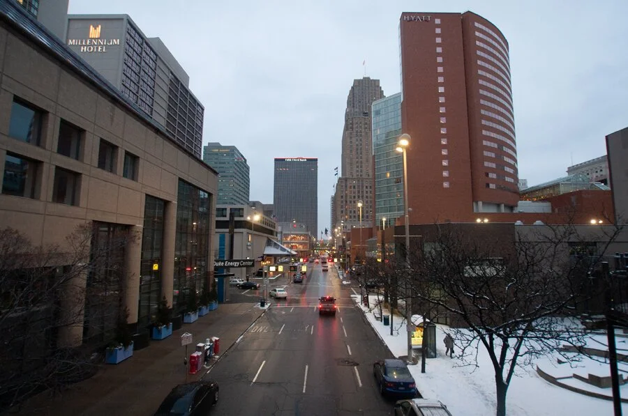
Looking north on Elm St. towards the Convention Center and Millennium Hotel.
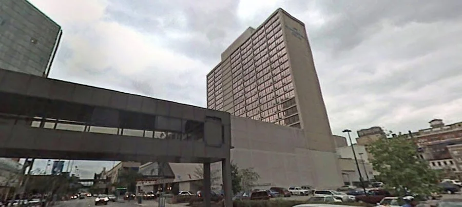
The Millennium Hotel seen above eventually closed in 2019. The massive convention-style hotel was mired with a questionable reputation in its later years. The current plans call for the structure to be demolished and replaced with a new hotel. Historically, the Millennium was once known as Stouffer’s Cincinnati Inn and then expanded with a second tower to become Stouffer’s Cincinnati Towers. During its prime, the 32nd floor featured a revolving restaurant. The same company that’s today known for its frozen foods, Stouffer’s once also included restaurants and lodging establishments in its portfolio. In a map seen at the end of this post, this corner is declared to feature both the Millennium and a Sheraton Four Points. I’m not sure where the Sheraton branded hotel would’ve been, if it was demolished, or if the Millennium eventually took it over/expanded. Matt Hunter Ross of Cincinnati Revisted has an excellent post about the history of the Stouffer’s hotel and this section of Downtown in general (replete with some great vintage photographs). This section of the city’s core has an interesting history, one heavily altered by mid-20th century construction and design ideals. The convention center opened in 1968 at a time when Skywalks and urban renewal were all the rage. Both the original Stouffer’s hotel and the expansion arrived to meet demand created by the convention center.
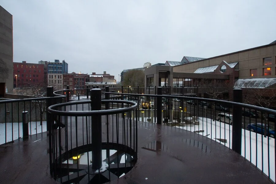
Revisiting the notion that parts of Cincinnati’s skywalks were exposed to the elements, this portion that connected/still connects the Hyatt to the convention center didn’t even have a covering.
The outdoor portion linking the Hyatt to the convention center is wildly different in design than the rest of the system, so much so that it’s hard to believe it’s an original connection. The curved walkway skirts around “Shapes Park,” an outdoor art installation that was once designed as an exercise area and has now become a favorite skate spot (as covered by City Beat). Seen in the distance of the above photograph, the Skywalk resumes an angled and more “business-like” aesthetic near the convention center. Looking at the Historic Aerials website, it seems there was once a building here that may have been part of the Skywalk system. While the images are blurry—the building exists in 1970, but it’s been replaced by Shapes Park by the time of the next image in 1993. The more eclectic, outdoor Skywalk connection seems to have emerged after the office building was demolished.
Also, this general area is home to a building labeled as the “Convention Place Food Court.” I’ve never seen any dining establishments open there, though, both back in 2008 and today. This website has an interesting, quick write up about the place maybe once having been a mini mall. If you know something more, though, I’d love to hear it.
Skywalk over West 5th St. connecting to the Duke Energy Convention Center. Note that this section is mostly open to the elements.
Looking eastward back towards the Carew Tower and Fountain Square alongside the Convention Center (left) and Hyatt Regency (right).
The day I photographed the Skywalk, it was the kind of day the system was (somewhat) designed for: cold and inhospitable. Since the convention center had no events going on, though, the system just dead ended there. Not that it mattered, most of the other bridges on the opposite side just connected to (and still do) to parking garages. The system ended here, but there’s one peculiar thing that stands out, something I never picked up on when I originally wrote about these photographs.
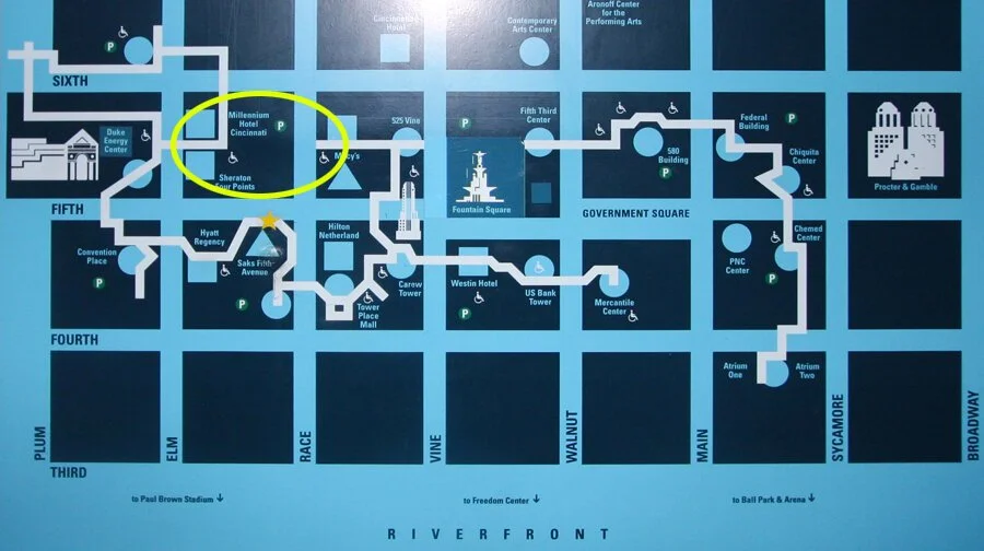
A map seen in the Hyatt/Saks section in 2008. Emphasis added.
The convention center also featured a Skywalk bridge directly to the Millennium Hotel. In 2008, I never photographed this section. The Millennium occupies about half the block at West 5th/Elm Streets and earlier I mentioned a demolished building replaced by a parking lot that featured a “temporarily closed” Skywalk bridge from Fountain Place (now the 84.51° headquarters). If the demolished building was also once connected to the Millennium via Skywalk, the map would have once looked like this:
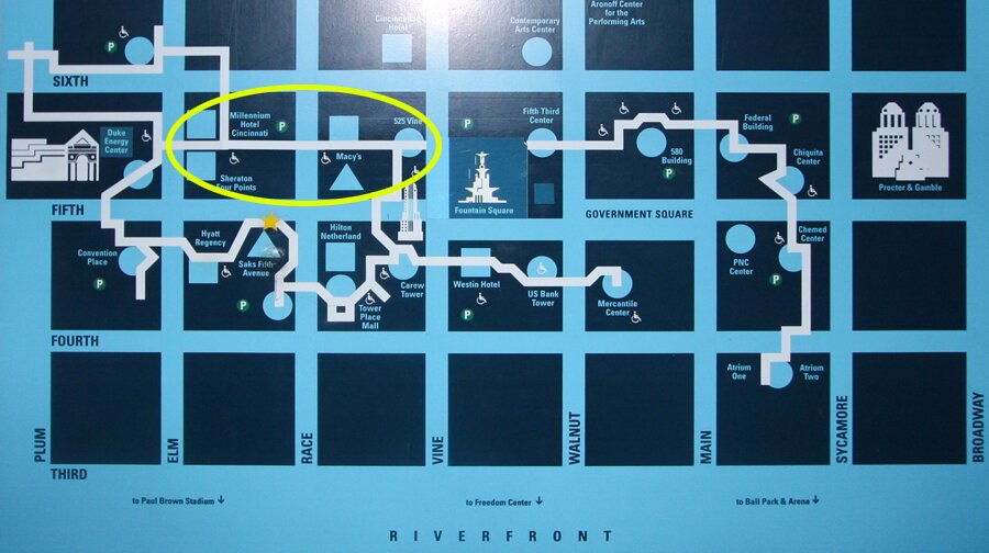
And if all that existed at the time of the northern Vine St. bridge/full Fountain Square connection, the map would’ve looked like this:

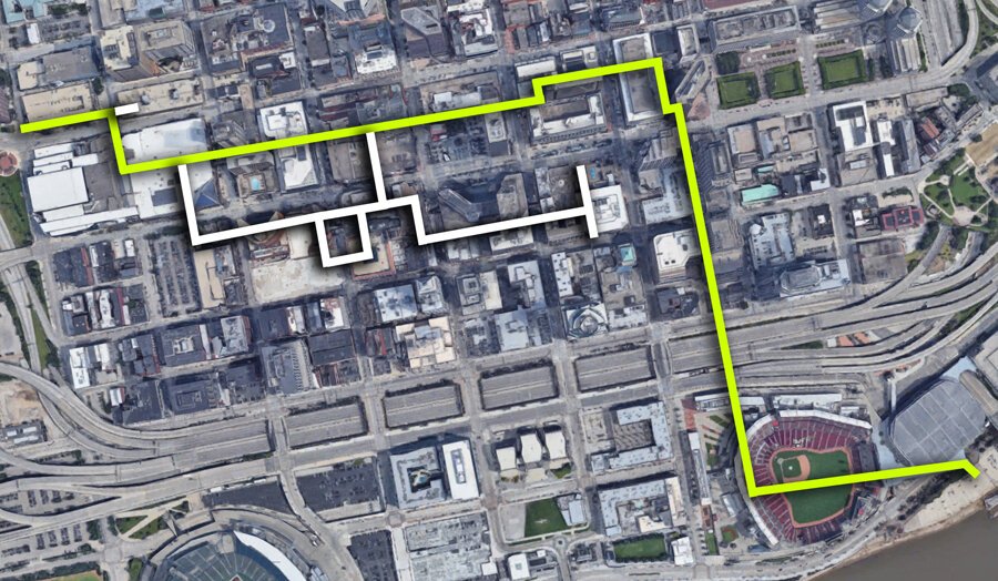
If the system once existed in full as theorized above, it would’ve once been possible for someone to enter the parking garage at Central and 6th St. on the western edge of Downtown and then walk all the way to the riverfront arena without touching the street level once, via a route like this (yellow):
This theory (if you can call it that) is bolstered by the fact that another section of Skywalk once existed about West 5th St. and connected to the empty parking lot (now 84.51° building) referenced earlier. Google Street View shows the section existing as of October 2007, but removed by August 2009.
Via Google Street View.
Back when I originally made these photographs in 2008 (and up until writing this now in 2020), I never realized the segment seen above even existed. Perhaps it was gone by the time I started shooting? Either way, it shows how the Cincinnati Skywalk system once featured more connections (and proves that you can still learn something from digging up images from over a decade ago).
If you know more about how the Skywalk was originally designed/connected, what the original segment was, or if you remember the whole thing in its heyday—I’d love to hear from you in the comments below.
-----
EDIT:
Per a discussion on UrbanOhio.com, it seems that the Skywalk did once flow from the convention center, through the Millennium (Stouffer's), into the former 5th/Race Building (84.51°), over Vine St., over Fountain Square, and into the Fifth Third Center connection—making the above map/route a real possibility. The awesome John Yung has a great story of the entire system over at UrbanCincy.com.
-----
There are other “skywalks” throughout the city that aren’t technically part of the “Skywalk” branded system. Some are totally closed off to the public and some are far more simple in design. The aforementioned Cincinnati Refined article by the talented Phil Armstrong highlights those, as well as, some history of the “official system.” The final Skywalk segment was finished in 1997 and within five years, sections started coming down. A seemingly unrelated pedestrian bridge (that was covered in 2016 and is now demolished) further north in the West End/Over-The-Rhine at Music Hall may have been envisioned as part of an even more expansive system.
Summer 2015 view of the elevated walkway/bridge that connected Music Hall to the Queensgate II development parking garage.
I’ve never seen anything officially linking it to the main system, though, although I have seen documents referring to it as a “skywalk.” The term seems to be thrown around as both a generic designation and official moniker of the mapped Cincinnati system. Related: the Music Hall Bridge and its associated urban renewal development were of the same vision/era/design/thinking as the convention center. That's a whole other story in its own right, one I documented for Cincinnati Public Radio/WVXU.
The Skywalk over West 5th St. between between the Carew Tower and Fountain Place as seen during the 2015 Major League Baseball All-Star Game.
A lot of what is seen in these images still exists as of this writing, but the surroundings have changed. This post too, stating things as “current” and “today” will also eventually be dated. Cincinnati, at this moment, stands at an interesting crossroads. The development of the urban core faced challenges and competing visions even before COVID-19 struck (and as many await the economic fallout). In almost all of the ideas thrown around, it seems the Skywalk is of little concern to anyone. Any branding/maps still found along the way should be taken with a grain of salt and really, should you find yourself at a dead end: you’re better off just walking outside on the sidewalk instead. There are few cities these days that seem to be actively promoting their skywalk systems and those that do are typically in harsher climates than Cincinnati. Nevertheless, there are still those who make use of the system. During my time working daily in the Central Business District, I’d occasionally use parts of the system to duck out of the rain/snow on particularly harsh days when I was running to grab some food or visit the store. My usual lunch places and hangouts, though, were all located at street level and on the sidewalk.
When I dug up these photographs and decided to re-share them, I didn’t know if they’d be of any value or interest. Over the last few days, as I worked to finish this post up, I’ve found myself going down several rabbit holes, though (and once again staying up way too late working on this website). This has been a nice reminder of the curiosity that initially inspired me to start Queen City Discovery, a curiosity that’s still there. In something as benign as the Skywalk system, I can see a value in understanding it (even if that knowledge isn’t going to do me much good in terms of practical life).
When this pandemic is over, I can’t wait to go back and walk the Skywalk once more.
Update | November 2, 2022:
The Millenium Hotel has been demolished.
Saks Fifth Avenue has closed.
The aforementioned “Shapes Park” and its skywalk are actually a sculpture garden by a local artist. That story was covered here.
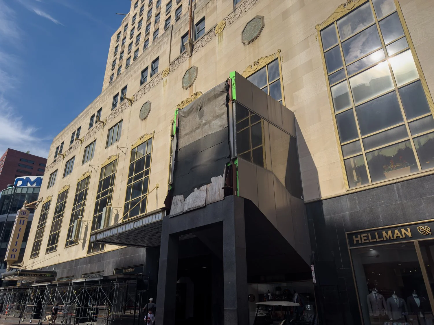
Update | July 9, 2025:
As the convention center undergoes a massive renovation, several more pieces of the Skywalk have been removed. In the image below, you can see the remains of one sticking out of The Carew Tower. An updated map and more details can be found in this post.
Update | February 22, 2026:
Published a new story to document the latest status of the Cincinnati Skywalk System.
Since 2007, the content of this website (and its former life as Queen City Discovery) has been a huge labor of love.
If you’ve enjoyed stories like The Ghost Ship, abandoned amusement parks, the Cincinnati Subway, Fading Ads, or others over the years—might you consider showing some support for future projects?