Highways for Houses
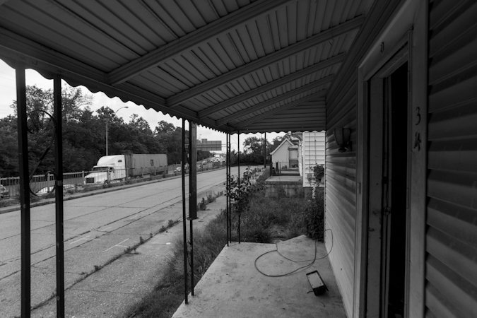
The porch of an abandoned home in the Village of Lockland overlooking nearby Interstate 75. The home will soon be demolished to make room for the highway's widening and sound walls.
Ronny Salerno
They built the highways right through the quiet blue collar town. The freeway became the life blood of our economy, the primary mode of transport. And in a village that was once the embodiment of post-war America, it's industrial base faded as a nations's arteries grew clogged. In a new century where the continued increase of highway capacity is being questioned, I-75 is chipping away at Lockland once again.
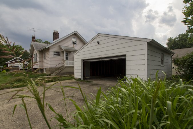
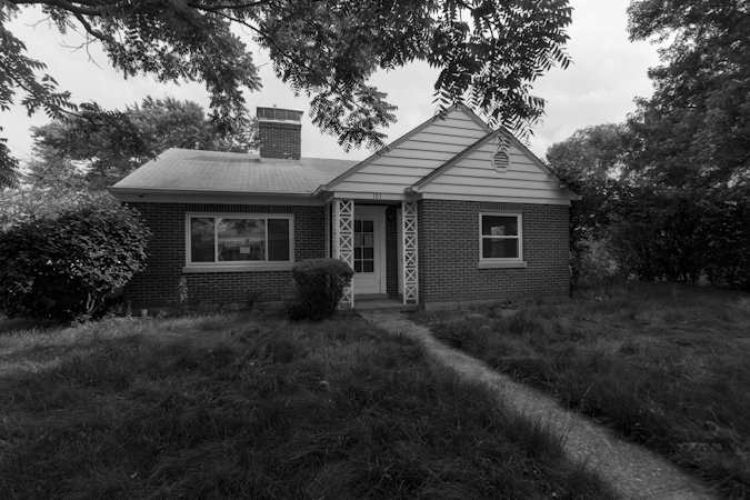
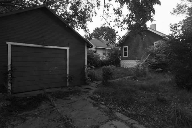
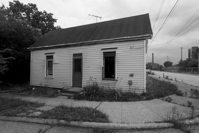
An abandoned residence in Lockland.
Ronny Salerno
Lockland is no stranger though to the advances of technology and transportation. It's a place that was born on the banks of a canal. Then the railroads came and then the automobile. The stagnant canal was drained, abandoned and converted into one of the area's first freeways - connecting Cincinnati to Lockland's wartime production industrial core. The bomb was dropped, our enemies surrendered and a victorious America emerged from World War Two with a booming economy and new sense of prosperity. From shining sea to shining sea, new multi-lane interstates began connecting our cities.
In 1941, the completion of the "Wright Highway" on top of what had once been the Miami-Eerie Canal provided a direct path straight into Lockland. Named for the village's Wright Aeronautical factory, the highway delivered an easy path for the thousands of workers manufacturing airplane engines. Today that plant is now the offices of General Electric.
With the passing of the National Interstate and Defense Highways Act of 1956, the Wright Highway became Interstate 75 as progress expanded it northward. The burgeoning suburban population of Cincinnati and rise of the automobile caused the highway to expand further, adding new lanes to handle the ever increasing traffic. In 1963, the "split" was born when new northbound lanes were constructed, causing the directional lanes of traffic to split around the village of Lockland. The only remaining portion of the Wright Highway that was left, is where the highway flows down into a valley of concrete retaining walls infamously known as "the trench."
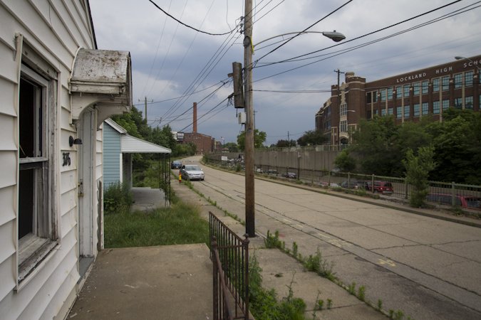
"Where the sidewalk ends." Just beyond the trees are the northbound lanes of I-75 that pass directly through the Village of Lockland and severed this sidewalk from the rest of the neighborhood.
Ronny Salerno
Cincinnati's highways are different than much of the rest of the nation though. They wind and twist through densely populated hills that surround the metropolis and feature narrow right-of-ways with precariously curved ramps. Yet, the highways had to grow to handle the ever increasing automobile traffic.
Walter Kulash once said that "Trying to cure congestion with more capacity is like trying to cure obesity by loosening your belt." Kulash, a traffic engineer from Orlando, is one of many vocal advocates to have emerged in the 21st century arguing against increasing the lanes of highways. In some parts of the nation, cities are actually removing freeways and seeking out new alternatives. In Ohio though, we're currently sticking with the status quo as the "Thru the Valley" project continues at full pace, set to be completed in the fall.
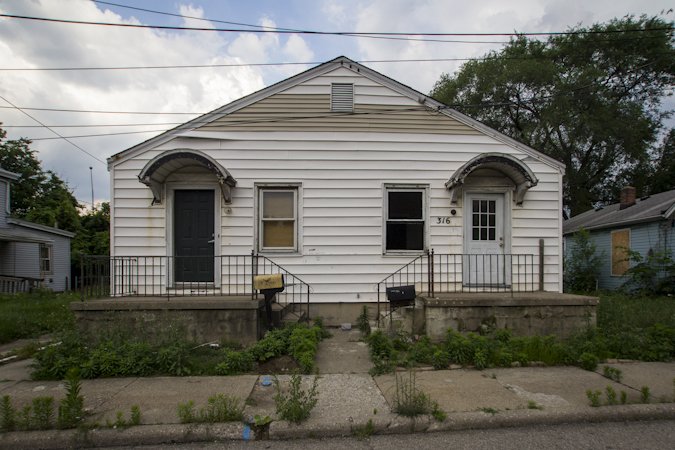
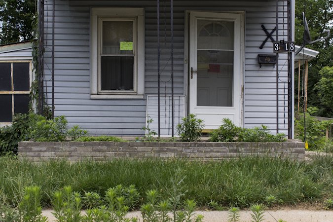
The project will add four more lanes to I-75 and modernize many of the highway's awkward interchanges while adding sound barriers throughout the highway's path. In Lockland, this means the acquisition of numerous homes - the owners of which received fair market value for their property. Last week, QC/D reader Greg Spahr tipped me off about the Lockland homes currently being vacated and demolished.

Ronny Salerno
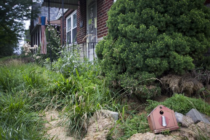
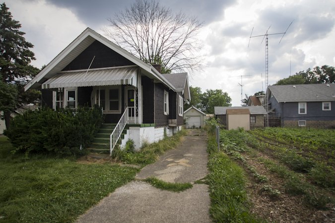
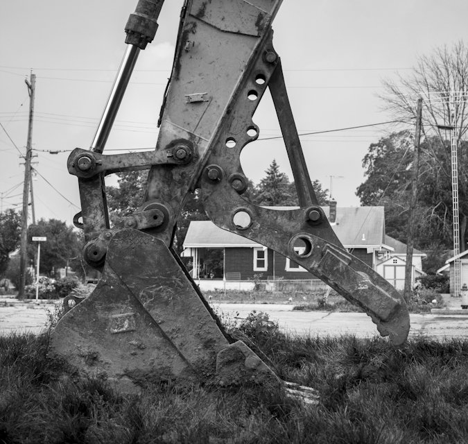
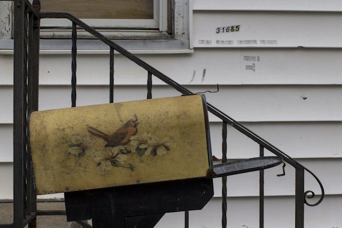
We toured the neighborhood streets that sit just feet from the highway and in some cases overlook it from atop the "trench." A few personal belongings remained scattered about, the addresses were still on the mailboxes and a backhoe loomed nearby on the freshly brought up dirt mound that used to be someone's home.
Through Lockland, the interstate grows again.

A bowling ball, one of many personal belonging strewn about the outside of one of the abandoned homes.
Ronny Salerno
Lockland's proximity to I-75.
Ronny Salerno
Ronny Salerno
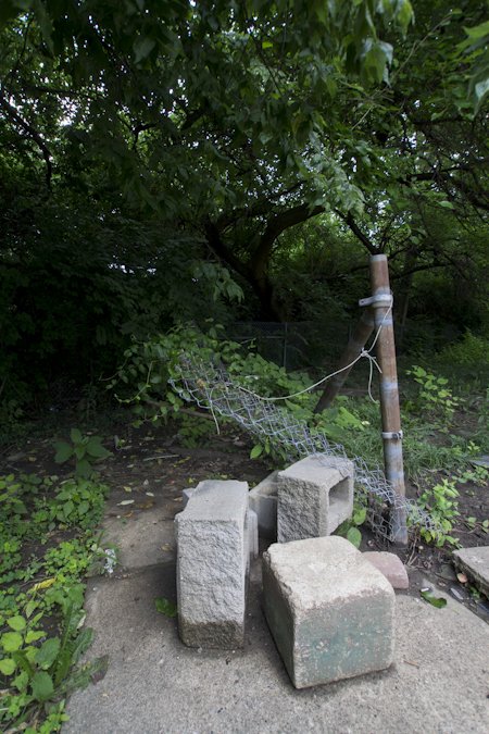
Personal belonging outside an abandoned residence.
Ronny Salerno
Ronny Salerno
Ronny Salerno
Ronny Salerno
Ronny Salerno
Ronny Salerno
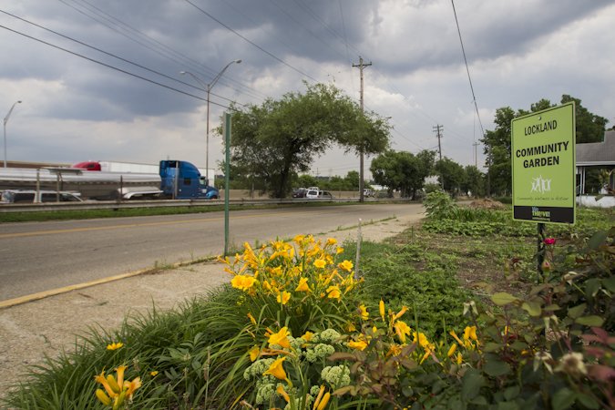
The Lockland Community Garden is in the direct path of demolition.
Ronny Salerno
Cameron Knight
Ronny Salerno
Ronny Salerno
Ronny Salerno
Ronny Salerno

Ronny Salerno
Ronny Salerno

Ronny Salerno
Ronny Salerno
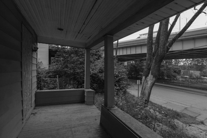
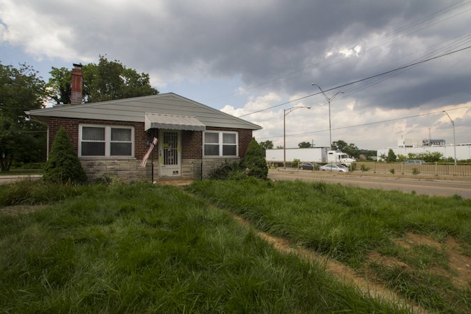
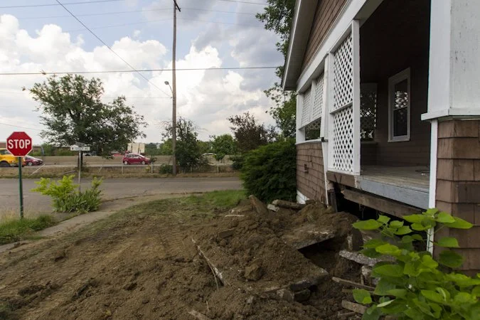
From the porch of a soon to be demolished residence. The neighboring highway can be seen in the upper right.
Ronny Salerno
Special thanks to Greg Spahr.
Update | Oct. 22, 2017:
As of this update, all the houses have been demolished and work on the highway is ongoing.