The Abandoned Pennsylvania Turnpike
Up to that point I had never had a more terrifying experience while driving. I was trying to keep an eye on the semi in front of me, following his movements while avoiding smashing into him. Behind me: a continuous line of yellow lights presumably trying to do the same thing.
Following the truck was easier than trying to make out the road through the torrent of rain. I couldn't even hear the music over the water smashing my car. Not that it mattered, I wasn’t going to remove my hands from the steering wheel to make the stereo volume compensate.
Things subsided at the summit when the rain hesitated for a moment before the road began angling down, continuing to wind. As the caravan gained speed downhill, the rain intensified back to its earlier pounding and then came the fog.
After another thirty minutes, all the cars reached the bottom, the road straightened out, and the rain eased to just a steady drizzle. I pulled over along with a few other drivers who had the same idea. We didn't say anything, just nodded in acknowledgement as we lit up cigarettes of relief, stretched our legs, and calmed our nerves.
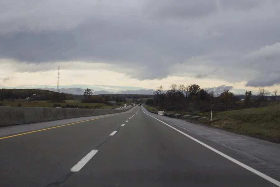
I had left Leonardo, NJ that morning concluding a trip to a cousin's wedding and my first visit to New York City. I had been spending the day meandering across the state of Pennsylvania after I instructed my GPS to avoid highways. This was the start of a road trip back to Ohio. The day had been pretty uneventful and I hadn't seen much. Nevertheless, cutting through the small towns beat the monotony of the Pennsylvania Turnpike that I had driven on my way up.
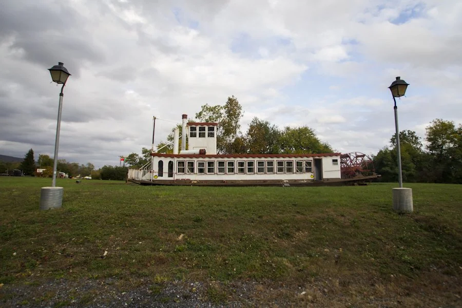
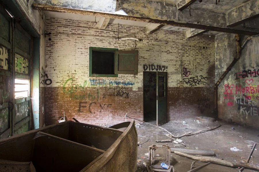
Roadside riverboat in PA.
The last leg of the day's route required me to drive through the Appalachian Mountains before reaching Breezewood. That's where I encountered the rain, the fog, the caravan, and a terrifying drive.
Now that it was over, I calmed down and pulled into the oasis of fast food and lodging that lit up the night sky. I stopped at a McDonald's and scarfed down some food from less than enthusiastic employees. I sat in the parking lot, judging hotel rates on my phone while I contemplated just sleeping in the car and saving what little money I had. I found a quiet, roadside motel known as The Wiltshire tucked back off the main road. The owner was just about to head to bed when I walked up and found him sitting outside with his dog. We made conversation as he took my credit card and grabbed some keys. His price was way cheaper than those immediately off the highway. The conversation after a long day of talking to no one made it worth every penny.
As soon as I entered the room I felt like collapsing. I grabbed a quick shower and fell onto the bed with no alarm set. I didn't care.
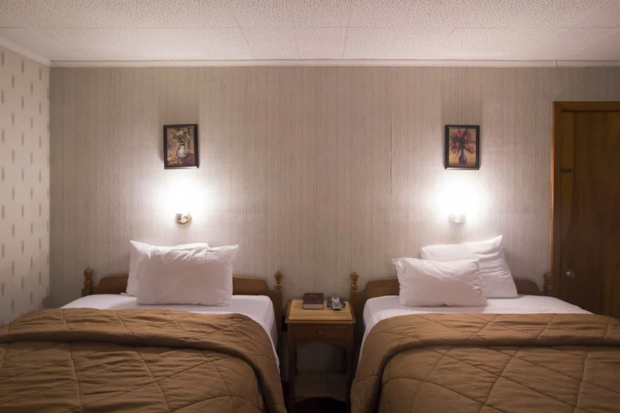
A room at The Wiltshire.
I woke up the next morning, took inventory of my things and prepped the car. The rain had resumed and was continuing its steady pace. I returned my key, thanked the owner and offered a lift to Denny’s for a trucker who was stranded overnight when his rig broke down. I told him my plans for the day: to go exploring the abandoned sections of the Pennsylvania Turnpike.
"Just be careful,” he said. “That guy is still loose."
He was referring to Eric Frein, a survivalist fugitive from the FBI’s Ten Most Wanted List who had ambushed and murdered a State Trooper.
On the trip up a week earlier, I had taken the turnpike across the whole state. At one point, I had stopped for gas at one of those mega convenience marts. While walking back to my car, I heard a radio squawking. I turned around to see a state trooper walking about ten feet behind me. I politely nodded and walked to my car. I unlocked the door and was about to get in when I heard: "Sir, do not enter the vehicle."
I turned around to see a trooper who cut off my "can I help you?" with a: "What are you doing here, sir?"
I explained that I stopped for gas and to get the bottle of iced tea in my hands.
"Where you coming from?"
“Cincinnati.”
"Where you headed?"
"Jersey.”
"Ok, have a nice day,” he said turning away.
"Is there a problem?" I asked, slightly annoyed, but halfway concerned.
“Nope,” he said turning around and not even breaking stride.
I made the rest of the trip to New Jersey and when I got there, I was explaining to a family member about my plans for some urban exploration on the road trip home.
"Well that guy was last seen near the Poconos, so you should be ok, but I wouldn't go off trekking into the woods alone if I were you," an uncle remarked.
At the time, the fugitive Frein hadn't been seen in awhile. The manhunt for him wasn't turning up much: a few alleged sightings and some pipe bombs in the woods. I still don't know why the trooper questioned me at the rest stop, but I imagine the police—especially the state troopers—were all on edge with that guy still out there (although casually cruising down the turnpike and stopping to get snacks in a mid sized, moderately priced 2010 sedan didn't seem to fit his murderous M.O.). Now days later and amongst the roadside hellscape that is Breezewood: I wondered about Frein. The most recent reports said he was last seen on the other side of the state. But, what if he had found a way to get here and was hiding out in the abandoned tunnels I'd be looking for? What if we came face to face?
"Maybe he'd sit down for an interview, that’d make a good QC/D post."
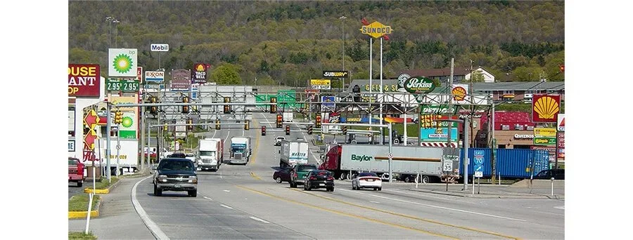
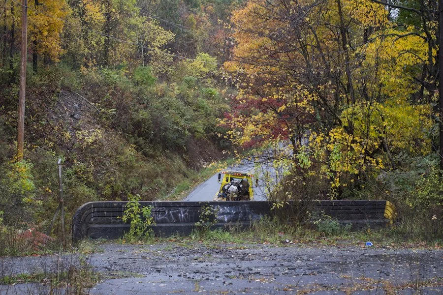
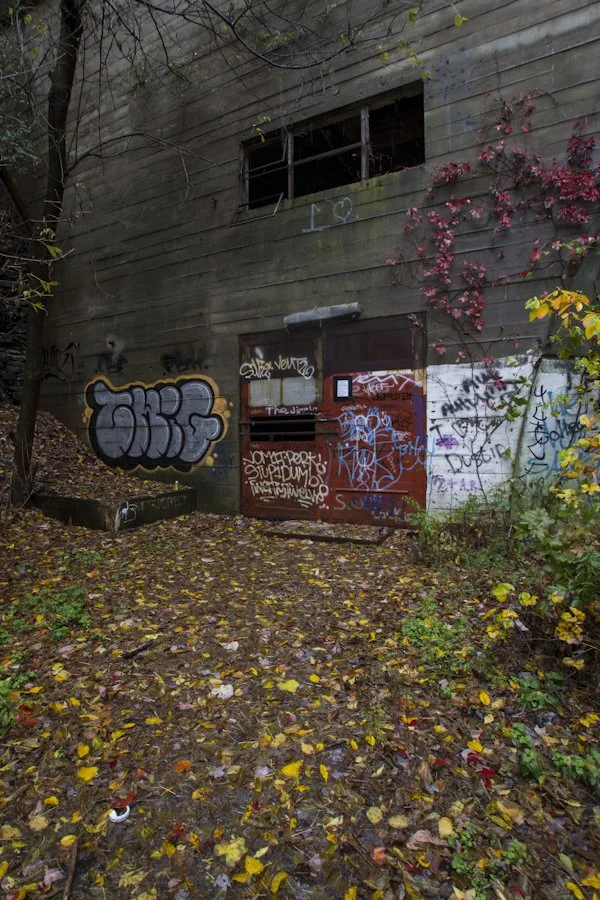
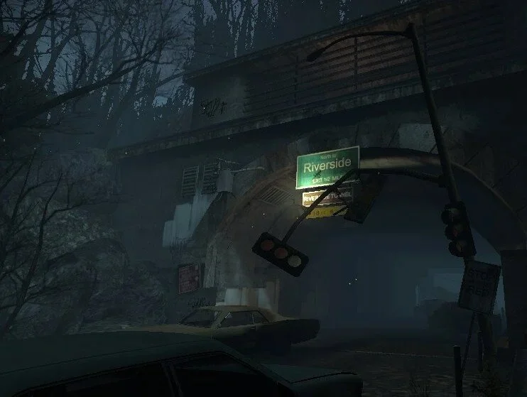
The Breezewood, PA interchange of the Pennsylvania Turnpike.
Image via Wikipedia.
I wasn't going to be deterred, but I had a backup plan in case I met any crazy right wing, survivalist nut jobs hiding in the woods. As I parked my car and prepared to hike, I dropped a pin on a map and sent the coordinates to my friend Matt with the instructions: "if I go missing, my car's here."
Camped out killers weren't the most pressing or realistic problem, though. The rain had picked up again. It had been steady throughout the morning, but now it was just as bad as when I had come through the mountains the night before. I went to a truck stop and purchased a few ponchos. I used one to secure my bag and protect the lenses within. I donned my camera and its smallest lens on my neck, then threw another poncho over my body. I grabbed my tripod and started the 1.5 mile hike.
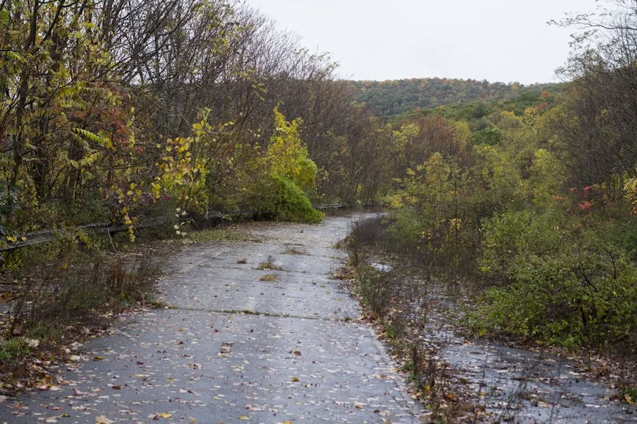
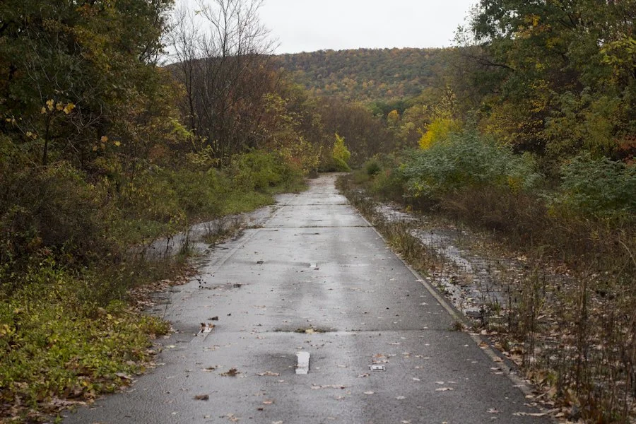
A typical view of the abandoned PA Turnpike.
The hike was long and boring, just like driving on the turnpike is. Occasionally, I’d see a few things to break up the monotony. A few houses butt right up to the crumbling asphalt and at one point it crosses over an active road.
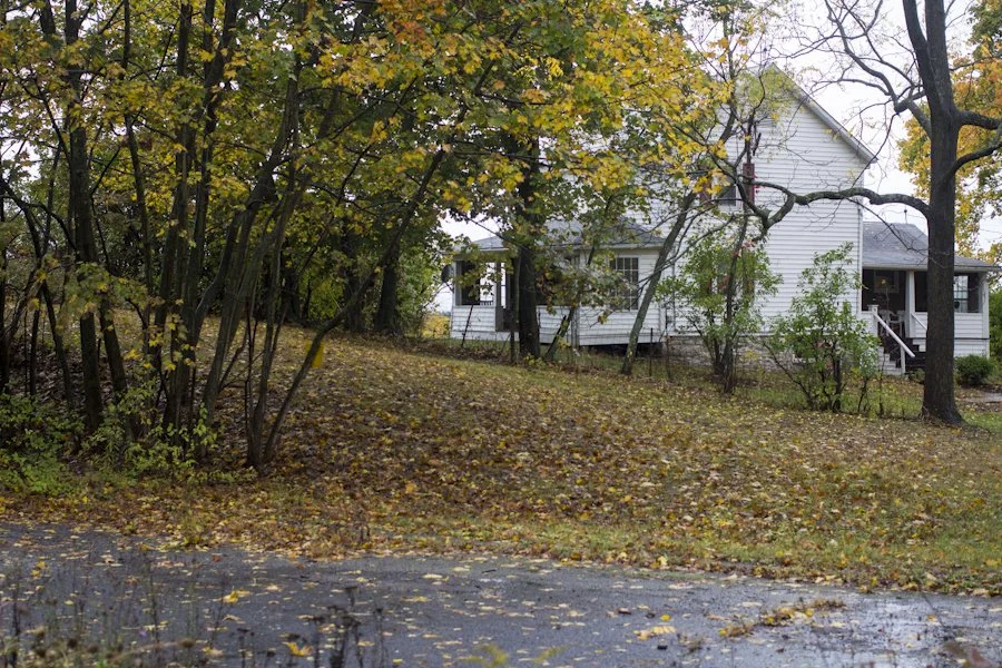
A house adjacent to an abandoned section of the Turnpike.
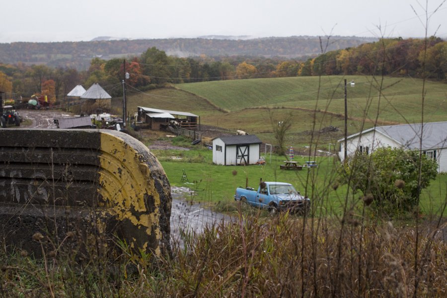
Farmland as seen from a bridge that still supports a section of the abandoned turnpike.
Truck passing below a section of the abandoned turnpike.
I had given up on wearing my perpetually fogging glasses. Every now and then I’d stop, deploy an umbrella, and then carefully maneuver the poncho to snap a few frames with the camera one handed. The rain just wouldn’t ease up.
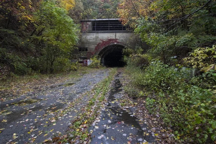
It started getting so hard that all I could do was look down at my boots as they trotted over layer upon layer of fallen leaves. Eventually I looked up and saw the gaping black hole of the tunnel in the distance, I was nearly there. Almost poetically, the rain stopped as soon as I stepped into the tunnel. I took a few minutes to take it in, stare down into the darkness and take off all the rain gear.
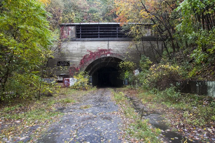
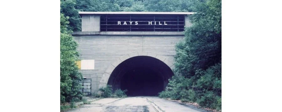
I had made it to Rays Hill.
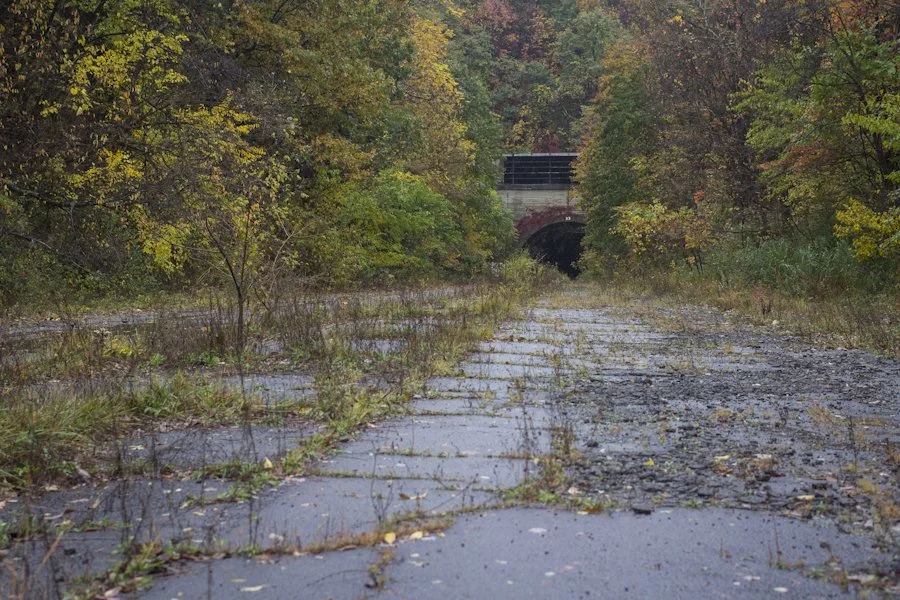
Approaching the Rays Hill Tunnel.
This wasn’t the first time the Rays Hill Tunnel had been abandoned. It started life being dug out as an artery for the South Pennsylvania Railroad. The South Penn's construction was a project headed by magnates William H. Vanderbilt and Andrew Carnegie. They planned to open up a new freight corridor in Western Pennsylvania, one that would counter Vanderbilt’s biggest competitor: Pennsylvania Railroad. The new rail line’s route was being built directly through the Appalachian Mountains and required nine tunnels to be constructed, one of them being Rays Hill.
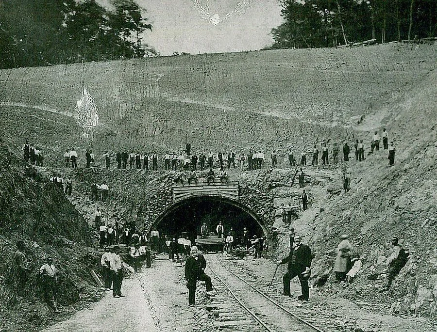
Andrew Carnegie posing with a construction crew at the Rays Hill tunnel.
Image via Wikipedia.
J.P. Morgan, Vanderbilt’s chief investor, eventually grew concerned over the pursuit of competition. The new railroad was becoming expensive and 27 workers had been killed during its construction. In 1885, Morgan convinced Vanderbilt’s New York Central Railroad board to seek out an alternative route to Pittsburgh and abandon the existing construction. The failed railroad and its now abandoned tunnels became known as “Vanderbilt’s Folly.”
The railroad right-of-way sat abandoned for fifty two years until the Pennsylvania Turnpike Commission bought it in 1937. The Commission was born out of the Great Depression, heading up a plan to build America’s first “Super Highway.” When it opened in 1940, the Pennsylvania Turnpike had used 7 of the original 9 railroad tunnels, adapting them for motor vehicle use.
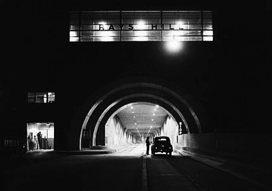
The Rays Hill Tunnel at night in 1942, two years after the turnpike opened.
Image via Wikipedia.
By 1959, the Turnpike’s popularity was causing problems. Traffic snarls were common at the tunnels where the highway would merge from two lanes in each direction down to one lane each. A plan was set in motion and by 1968 the problem had been solved (coincidentally the same year that Vanderbilt's once owned New York Central Railroad merged with rival Pennsylvania Railroad). The four tunnels still in use today were “twinned,” in which they had a second tunnel bored directly next to them. Three other tunnels and 13 miles of highway were completely bypassed creating what’s today known as the Abandoned Pennsylvania Turnpike.
The Rays Hill Tunnel in 2014.
I’m definitely not the first person to have explored the abandoned turnpike. I first heard about it from my friend Al Duce of DetroitUrbex and the internet is rife with videos, historical sites and documentations of others who have visited. It’s actually completely legal to visit the turnpike yourself, an adventure that doesn’t require plans to avoid being caught trespassing. The abandoned turnpike is kind of an “at your own risk” trip. In recent years, an effort has been put forward to adapt the thirteen miles of forgotten asphalt into recreational trails—a plan known as “Pike2Bike.” Restoration of the tunnels and roadway are planned, but haven't materialized yet. Nevertheless, the Southern Alleghenies Conservancy has made the abandoned turnpike open to the public, posting up a few signs indicating their “at your own risk” policy. My initial plan was to bring my bike along and cycle all 13 miles, but the logistics of hauling it to New Jersey, New York City, and then to the turnpike made things too complicated. Not that it mattered, the condition of the roadways and the fact that the tunnels are unlit would’ve made things slow on top of the torrential rain.
30 Second Exposure using natural light to highlight the tunnel.
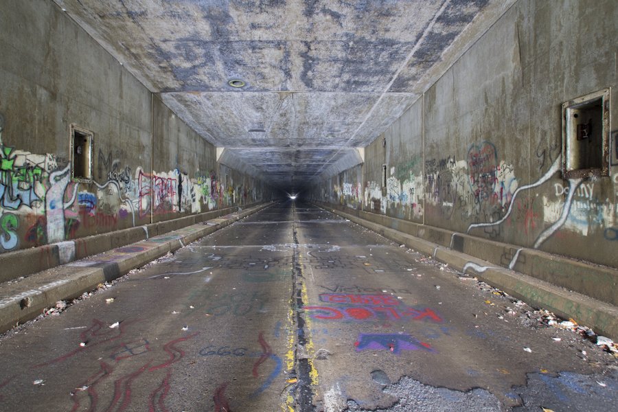
Looking down the tunnel, all you could see was darkness except for a white dot at the center—the other portal. The Rays Hill tunnel was the smallest on the turnpike at 2,532 feet. My flashlight couldn't pierce the darkness in the way the camera's long exposures could. In the end, I decided against going further, mainly due to the long hike back with heavy gear in the recently resumed rain. I won't lie though, the thought of walking through the tunnel alone made me a little uneasy. It was incredibly long and dark.
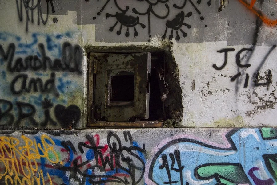
Doorway to the ventilation controls at the tunnel's entrance.
Lighting fixture in the tunnel's ceiling.
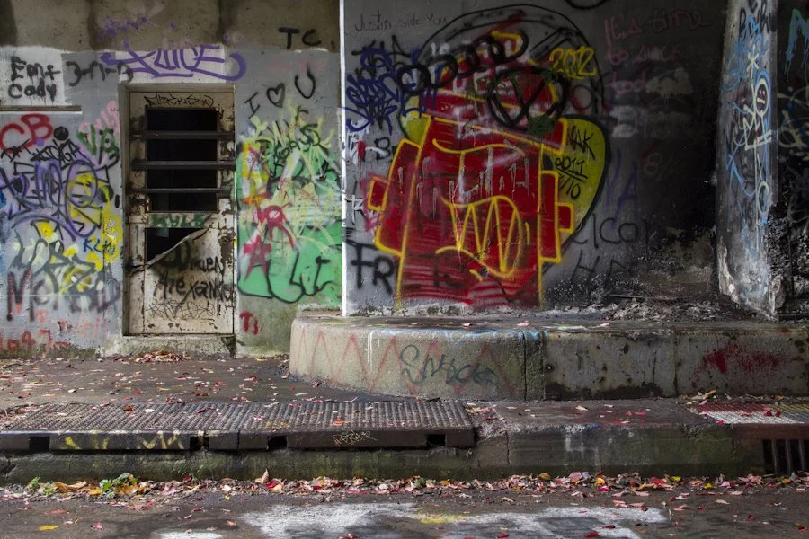
Entrance to the ventilation control room.
Looking inside the ventilation control room.
The tunnel had a few leaks, but for the most part was a dry shelter. It’s an impressive structure that despite the overgrowth still sticks out amongst the brush—a temple to human engineering amongst nature. Vandalism has taken its toll, though, with spray paint lining every surface you can see and the glass of the windows long gone. The ventilation control room’s doors are sealed up with metal bars, although as you peek in, you can see that people have definitely been inside before. The iconic metal lettering that once adorned the entrance was stolen long ago.
Rays Hill Tunnel and its iconic metal lettering as seen in 1980.
Photograph by M. Dakelman.
The tunnel was a serene place. As the rain kept falling, I’d hear the engine brakes of semis in the distance on the active parts of the turnpike. The structure is eerie looking, but quiet and calming. For awhile, I just sat on the curb enjoying existence and shelter from the rain. This had been a place I wanted to see for so long and I was finally there, taking it in—an abandoned man made structure filled with history, tucked away in the Appalachian Mountains.
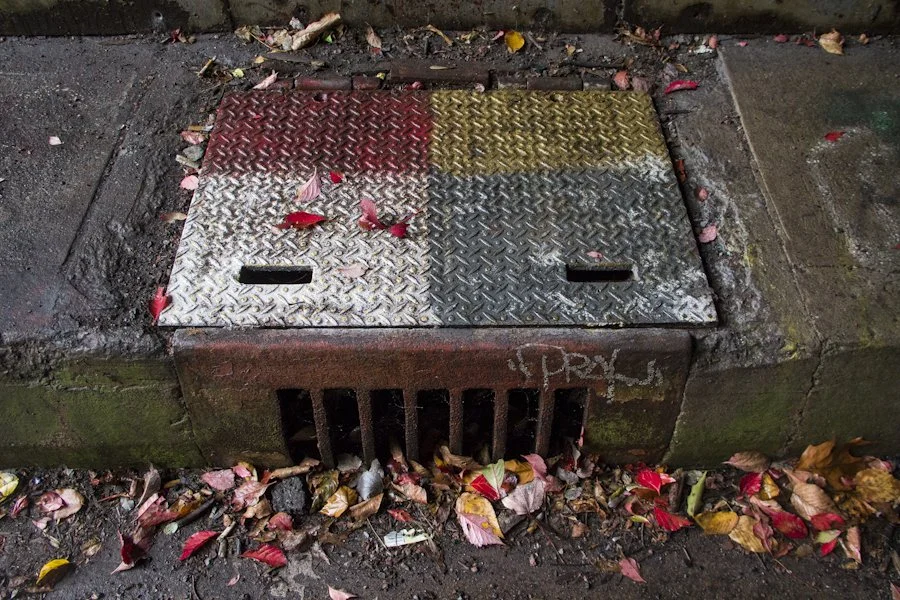
Storm drain at the tunnel entrance.
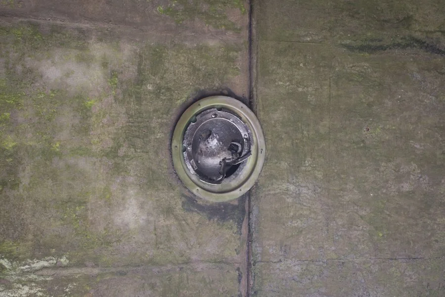
Tunnel ventilation shaft.
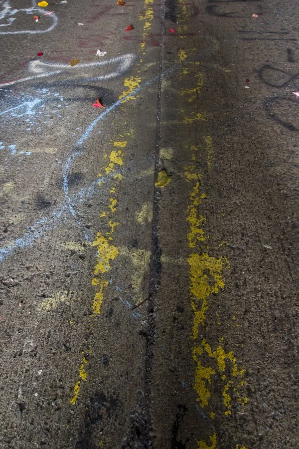
Roadway striping inside the tunnel.
Since it’s abandonment, these thirteen miles of turnpike and their tunnels have seen some use. Most of the highway relics found along the way aren’t original. Following its closure, sections of the abandoned turnpike were used to test the Sonic Nap Alert Pattern, better known by most drivers as the “rumble strips” on the edges of a highway that alert you if you’re veering off.
"Rumble Strips" were tested on the abandoned turnpike before being adapted to the Interstate Highway System.
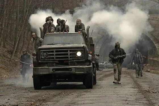
The U.S. Military also used sections for convoy training, in the lead up to the 2003 Invasion of Iraq. In popular culture, a similar tunnel at Sideling Hill was featured in the film The Road as an area where a band of roaming apocalyptic cannibals pass through.
The tunnels and their design were also the inspiration for a level in the zombie video game Left 4 Dead.
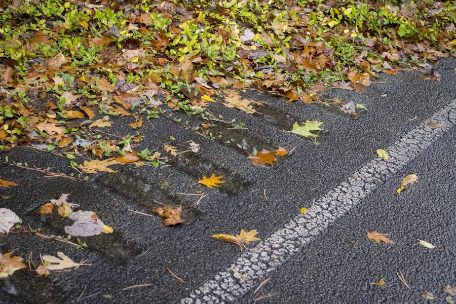
After getting the photographs I wanted and trying one last time to search for a way into the adjoining ventilation control rooms, I decided it was time to head back. I reconfigured my impromptu rig of ponchos and camera gear. With the rain now light, I could take the time to see the details of remnants along the road. Guard rails, rumble strips and lane reflectors occasionally don the asphalt—infrastructure that wasn’t there when the highway was initially abandoned, but that was probably installed for the aforementioned “rumble strip” testing.
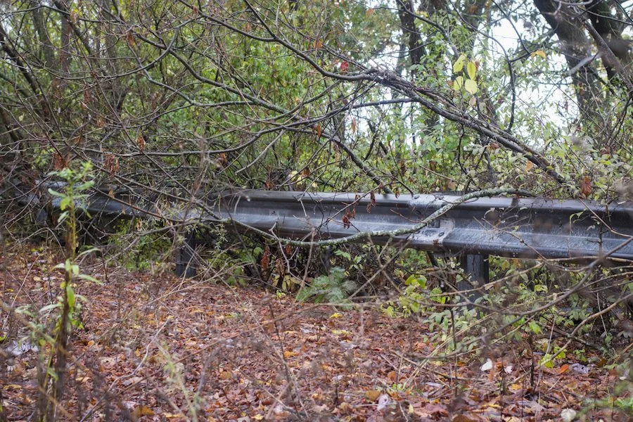
Guardrail installed along a section of turnpike. This particular guardrail is more modern, and was probably installed after the turnpike was abandoned and used as a test site.
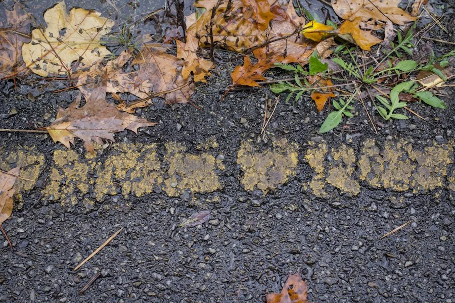
Faded lane striping.
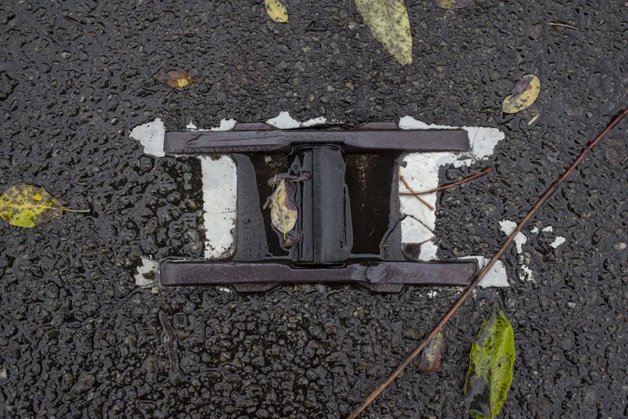
Lane reflector.
The walk back was wet and looked nearly the same as the walk to the tunnel. If you closed your eyes and spun in circles enough, you wouldn't know which direction you were heading.
I made it back to my car and then back to the truck stop, using its bathroom to change into some dry clothes and load up on coffee.
I had finally seen the abandoned turnpike, a place I had wanted to see for years. Despite the rain and the hike, it was one of the more rewarding explorations of any abandoned place that I had ever done. Anytime I explore these places, there's a sense of euphoria when you're done, a sense that you've accomplished something. This particular adventure had been the capstone, the end to a long trip between Cincinnati and the Northeast.
I pulled up to the toll booth, grabbed a ticket from the automated machine and started my drive home on the active part of the Pennsylvania turnpike.