The Abandoned Railroad Trestles of Ault Park and Their Future
Over the years, people have casually mentioned the railroad bridge towering over Red Bank Rd. as a suggestion of another abandoned location to photograph. Sometimes, they’d also recommend the “hidden” one, another forgotten trestle in the woods, just west of the big one. I’ve seen that one often photographed before. It frequently shows up on social media, the backdrop to stereotypical senior photos or fake candid images paired with sappy quotes. There’s usually a teenager walking along where the tracks used to run, caught in some counterfeit whimsy while wandering in the woods, their own personal recreation of the comping-of-age film “Stand By Me.”
I finally got around to checking it out one afternoon, biking around some nearby neighborhoods and looking for a quick way to duck into the woods. Looking at the location from Google Maps, I realized the “hidden” trestles were located in the heart of Ault Park, thus not requiring me to try and dash through someone's back yard. I stashed my bike and wandered onto one of the park's trails, meandering through the woods, and startling the birds that were hanging out in patches of sun.
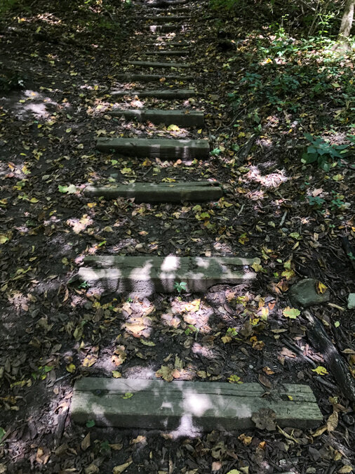 |
| - Makeshift steps that lead to one of the abandoned railroad trestles. |
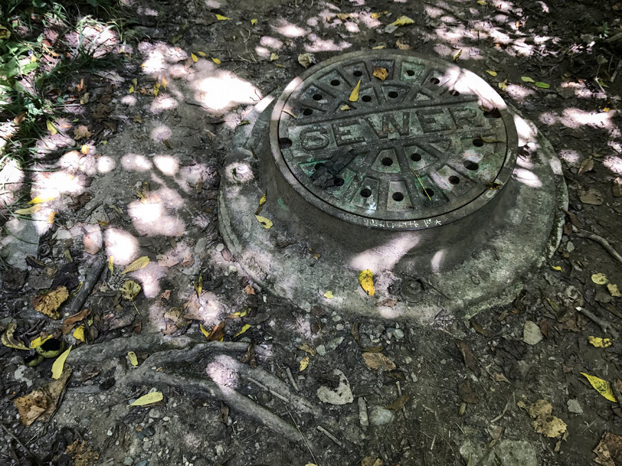 |
| - A sewer grate in the middle of a trail. |
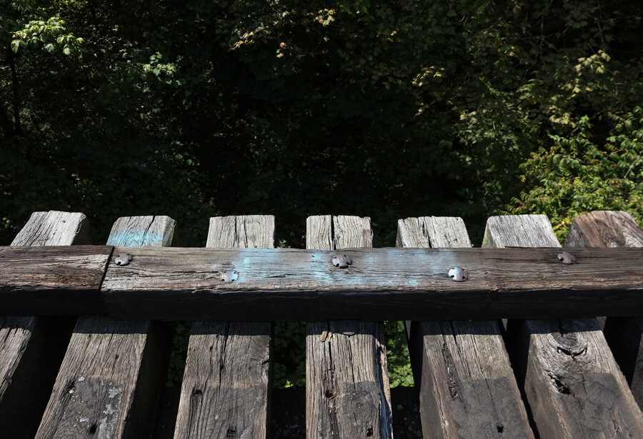
As someone who doesn't get around to much hiking, I checked online images of poison ivy, oak, and sumac, realizing that despite once being a Cub Scout, every plant looks like dangerous when you’re wearing shorts. My worn tennis shoes were poor clothing choices too, barely holding as I slipped down an embankment leading up to the former railroad tracks. In the middle of the city’s East Side neighborhoods, I felt pretty secluded, but the plethora of social media images, graffiti, and littering of Bud Light cans definitively proved I was not the first person to come here.
 |
| - Zipper graffiti on trestle supports. |
 |
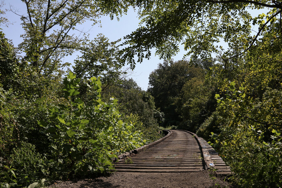
| - Looking at the smaller trestle from below. |
 |
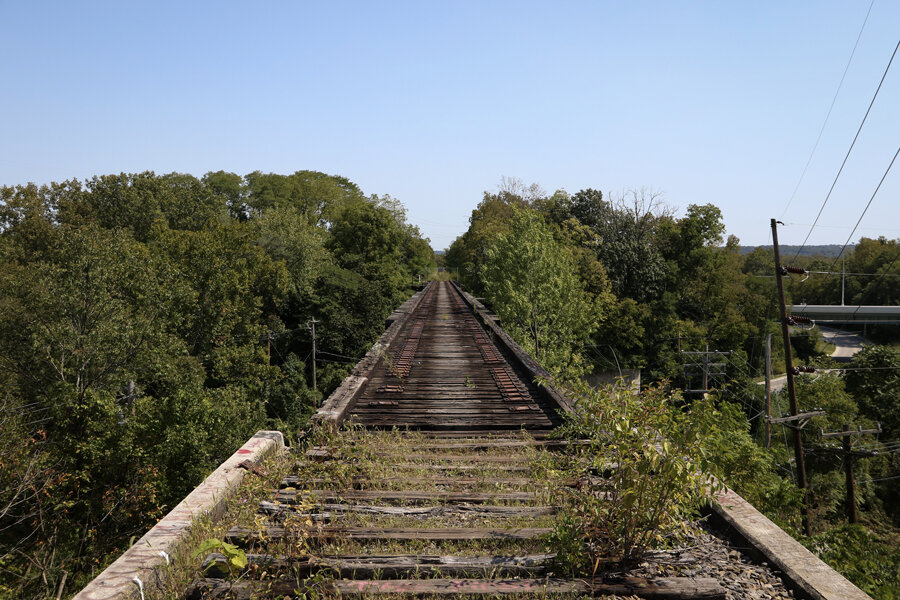
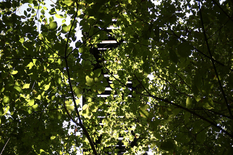
| - The "hidden" trestle. |
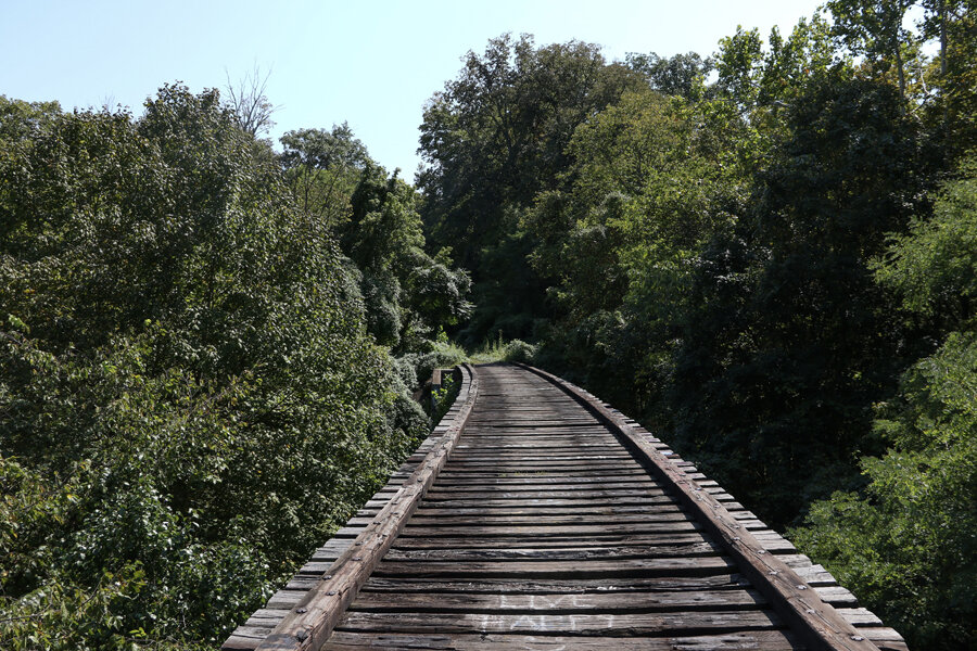
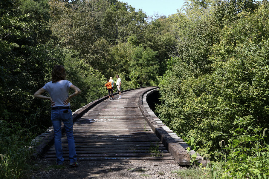
I wasn’t even the only one to visit that day, realizing this when voices in the woods turned into a family across the bridge from me. 3/4 of them walked the bridge with familiarity as I cautiously watched my footing.
You’re not going to fall through, but some of the ties seem questionable and it’s certainly going to hurt if one leg goes down, that old wood catching the rest of your weight. I’ve climbed roller coasters, half completed skyscrapers, and rooftops, yet this trestle wasn’t really my favorite thing. I tried to stay as center as possible while "lazarus lizards" ran all over, not minding the height.
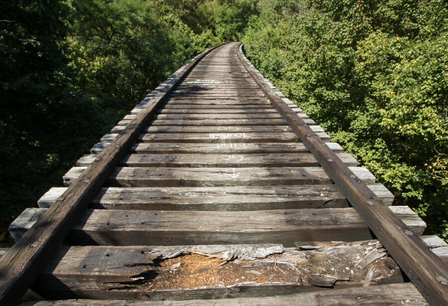
A woman in jogging attire confidently strode past me, clearly a veteran of the crossing, while I read the graffiti messages on the bridge. Most of them were as stereotypical as the Instagram posts from this place. One painted note asked Mike to prom, another encouraged onlookers to keep walking across and “go find yourself.” One misspelled the name, but claimed “Ronnie is a hoe.” The final one, as I neared the other side, read: “hustle, money, respect.” I doubt whoever painted that has a concept of any of the three.
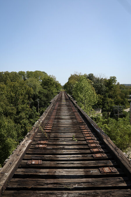
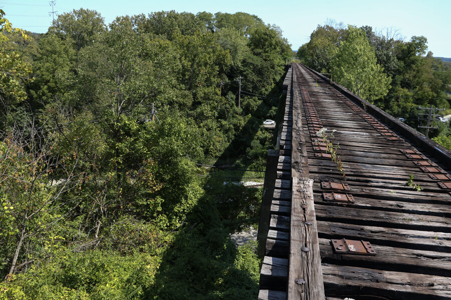
With nothing on the sides and only a view of power lines and a road below, I decided not to risk it. Judging from the lack of graffiti on this bridge compared to the last, I don’t think I’m the only one who’s made that decision.
 |
| - Looking down at Old Red Bank Rd. |
 |
| - Nearby power lines and Red Bank Rd. seen from above. |
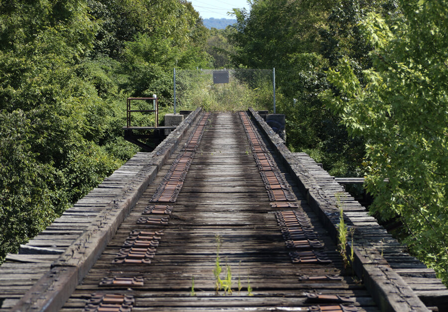
I turned around and headed back to the Valley Trail. As I was walking, another family approached: “Daddy, I wanna go to the train bridge!” The trestles are an interesting, somewhat hidden, but seemingly well known feature hidden amongst a beautiful park. However, they could carry people once again.

The former freight rail line linking these abandoned bridges is now part of the Wasson Way Project, a plan to connect Avondale to Newtown via a “rails to trails” bike/recreation path. Cameron and I authored a post on it (and another abandoned section of tracks) back in 2013. If fully realized, the Wasson Way would be a great asset to the City, a stunning example of reuse, and a unique connection between urban neighborhoods.
There’s an issue for some, though.
The project is envisioned along the former alignment of the Cincinnati and Eastern Railway, a narrow gauge line that opened in 1884 and ran east to Portsmouth, OH. Over time and multiple acquisitions, the thoroughfare found itself under the ownership of Norfolk Southern, who stopped running trains on this right-of-way in 2009. When the rails fell quiet and rusty, two competing ideas of reuse emerged: a bike path and a corridor for light rail transit. Linking several of the city’s East Side neighborhoods and passing within extremely close proximity to many popular destinations, the former freight line is a perfect candidate for rapid public transportation. In any large scale transit project, land and right-of-way acquisition can be one of the toughest and most expensive aspects. Yet, here, we have an intact corridor already linking dense population centers featuring plenty of room for transit oriented development. Utilizing this corridor for light rail would then only require the additional construction of a segment to link it with Uptown and Downtown Cincinnati near its western terminus. Imagine sleek, modern trains similar to the light rail vehicles on the existing Cincinnati Streetcar whisking passengers between the East Side and the city’s two largest economic centers.
But, there’s some who want this to be a bike trail and frankly, it's hard to argue against that. How could you not see the potential? At face value, it’s a fantastic idea. That is, until you realize how important this corridor could be for quickly stepping up the area’s regional transit plans. When you take into account just how vital this pathway could be to the future, some hesitancy against a bike trail grows.
Then there’s some who believe both can coexist. In July 2014, KZF Design released a study. Urban Cincy reported on it here and highlighted the three proposed options for the Wasson Way:
1) Fully convert to a bike path, making any future light rail construction extremely difficult and costly (least expensive for the bike path).
2) Create a path with room for both, the bike path taking priority at congested points that could be reworked later (middle ground expense for the bike path).
3) Fully preserve a rail right-of-way alongside the bike path, necessitating the creation of new crossings and bridges at various points (most expensive plan for the bike path).

The study recommended option number 2, which seems pretty fair, but this is a city where people don’t often understand rail transit. For all the progress that’s been made in the last decade, various groups tried (and failed) to stop the construction of the Cincinnati Streetcar at every point, from two failed ballot initiatives to a Mayor that swore he’d cancel it in an election night speech. Even before all that, the Cincinnati Subway was abandoned with plans to finish the project repeatedly ignored. The years that followed saw civic leaders fail to join other major cities and the Federal Government in pursuing rail projects, ultimately culminating in a failed 2002 vote for a regional rail network. Now, we’ve started to turn the tide and have the chance to finally start true regional, rail transit, finally catching up to fellow cities both of our size and larger (In Amazon's current search for a second global HQ they're specifically looking for sites with "direct access to rail, train, subway/metro, bus routes").
The Wasson Way website is pretty vague on the subject of future light rail preservation, but a representative I heard from was a bit more clear, stating that the project has taken inspiration from the aforementioned study. The group backing the project believes that a light rail/bike trail combination can be achieved and claims to have a plan in place to make it so. While it may be true that there’s room for both, let’s be honest here: if even just a portion of the bike path is realized and there’s an effort to install rail transit next to it, will people support that? I can already hear the opposition babbling straw man arguments/concerns of safety, noise, and ruining the atmosphere of a family friendly amenity. Couple all that with the usual opposition to transit and you’ve already created a pretty hostile environment towards progress. I don't fault Wasson Way supporters for this, advocating for a bike trail is certainly a worthwhile venture, but I don't see light rail gaining traction if the recreation path exists first.
I’d love to be proven wrong and believe the optimism of a shared corridor is genuine, but I have some sincere doubts.
On the other hand, conversion to a bike trail does preserve the right-of-way for transportation needs and prevents it from being divided up. While a light rail line would take years to design, study, plan, and construct, the path can be put to a good use in the near term. However, I worry that we’re handicapping the potential of future transportation. Maybe it's pessimism from studying Cincinnati's history and the local political climate, but I don't see people embracing rail construction next to their recreation trail.
As Jay Andrewss, one of the Wasson Way co-founders told me:
"The plan is for the trail to preserve the right of way for the next several decades. When the community decides to build light rail we have plans, based roughly on the KZF study, that have a trail with light rail. We have studied rail with trail and it can be achieved."

The project also hasn’t been without political controversy either. Had Mayor Cranley’s 2015 Park’s Levy passed, it would’ve greatly aided the full build out of the project. However, voters downed the controversial initiative 59%-41%. In May 2017, Cincinnati City Council Member Kevin Flynn took a hard stance against providing further funding for the project, citing that the originally touted “public/private partnership” had been disproportionately lopsided towards the public end.
As of September 2017, work is progressing along Phase 1 of the trail and the City of Cincinnati owns 4.1 miles of the proposed 7.8 mile segment. A small, half mile portion running between Withrow High School and Rookwood Commons is currently under construction. When the City agreed to purchase the land, the Cincinnati Planning Commission was pressed to include language in their approval that secured the future of light rail. Instead, a more vague “multimodal” description was used. The future of this right-of-way as a light rail corridor isn't sealed, but there is definitely room for doubt.
It's tough to argue against a bike path (and I'm not fully opposed to one), but it's just another odd chapter in the ongoing story of Cincinnati's attempts at progress. Another opportunity that seems squandered if there's not a firm commitment. One day, the abandoned trestles seen here may once again regularly carry people. Whether they travel via bike, train, or both, is another story.